
- Tags:
- ActivitiesEducational
- Where:
- International
- Date change rule:
- Every January
- Holiday emoji:
- 🧭
International Wayfinding Month illuminates the importance of clear navigation and spatial orientation every January. This observance encourages us to appreciate the thoughtful design of systems that guide us through complex environments. Take time this month to observe and improve the wayfinding in your daily life.
Want to sponsor International Wayfinding Month? Learn how
Expected International Wayfinding Month Deals
Throughout International Wayfinding Month, professionals and enthusiasts can anticipate a range of educational opportunities and specialized offers. Industry associations like the Society for Experiential Graphic Design (SEGD) often promote webinars and workshops focused on best practices in environmental graphic design. Software providers such as Esri and Mapbox may offer discounts on GIS tools and mapping platforms for designers and urban planners. Look for specialized training from firms like Gensler or Arup, which might host online seminars on creating intuitive public spaces. Retailers of navigation devices or educational books on urban planning could also feature promotions. We will update this page with confirmed live deals and educational events as January approaches.
Platform Guide for International Wayfinding Month
Tag National Today (linkedin.com/company/nationaltoday) and use #InternationalWayfindingMonth. Share insights on design principles and project successes.
X/Twitter
Mention @NatlToday and use #InternationalWayfindingMonth. Discuss the latest trends in urban planning and digital navigation.
Mention National Today (facebook.com/nationaltoday) and use #InternationalWayfindingMonth. Post about local wayfinding initiatives or historical navigation facts.
International Wayfinding Month Hero
Gerardus Mercator
History of International Wayfinding Month
International Wayfinding Month exists to highlight the importance of applying these information systems to our buildings and any large-scale project we are working on. To some, wayfinding is the act of finding your way to any destination, while to others, they are the information systems and techniques put in place in buildings to help you navigate and find your way. Both definitions are correct, as wayfinding encompasses the ways people navigate in any given environment.
Wayfinding was the traditional method used for navigation by the indigenous people of Polynesia to ease long voyages across the Pacific Ocean. Polynesians and Pacific Islanders used methods such as navigation by stars, bird observation, and wind patterns to navigate nearly every island across the Pacific.
In recent times, wayfinding techniques are usually used in architecture and the construction of buildings to enhance orientation and navigation processes. Starting with a book called “The Image of the City” in 1960, where its author, Kevin Lynch defined it. Another book, “Wayfinding in Architecture,” which was published several years after, further expanded the concept and included the use of signage and other graphic communication like visual clues.
Wayfinding is applied in several ways in buildings depending on the need for them. In transportation, it is applied using signage and information services for pedestrians and motorists, in healthcare systems they are used to provide directions for patients and visitors and signage support for individuals with certain conditions.
Other applications of wayfinding can be found in the creation of maps, digital displays, and symbols. There is no certain history for the creation of International Wayfinding Month but it is celebrated annually throughout the month of January.
International Wayfinding Month timeline
The people of Polynesia use wayfinding to navigate across the Pacific islands.
Wayfinding is first defined as an architectural necessity in the book, “The Image of the City.”
The book “The Image of the City” expands wayfinding to include signage and graphic communication.
"Wayfinding: People, Signs, and Architecture” is published and is referred to as the wayfinding Bible because of its vast inclusion.
How Businesses Can Celebrate International Wayfinding Month
Local businesses, especially those in design, architecture, urban planning, and transportation, can actively participate in International Wayfinding Month. Design firms can offer pro-bono consultations for local public spaces or host open houses to showcase their wayfinding projects. Public institutions like hospitals or libraries can run campaigns highlighting how their internal signage and digital maps improve visitor experience. Retailers in complex environments, such as large shopping malls or airports, can use the month to gather feedback on their current wayfinding systems and implement improvements, potentially offering small incentives for participation. Educational institutions can host guest speakers on the importance of spatial awareness and navigation.
International Wayfinding Month FAQs
When is International Wayfinding Month?
In 2027, International Wayfinding Month will again be observed throughout January, offering a full 31 days to explore the critical role of clear guidance in our environments.
Why is wayfinding important?
The importance of wayfinding cannot be overstated, as it directly impacts our ability to navigate unfamiliar or intricate spaces. Good wayfinding design enhances accessibility, promotes independence, and contributes to a positive user experience in both physical and digital realms.
What industries rely on effective wayfinding?
Industries from hospitality to emergency services heavily depend on clear wayfinding. Hotels and resorts use it to guide guests, while emergency responders rely on precise navigational systems to quickly locate incidents and provide aid, underscoring its broad and critical application.
Who designs wayfinding systems?
The creation of effective wayfinding solutions involves specialists in environmental graphic design, information architecture, and user experience (UX) design. These experts ensure that visual cues, spatial layouts, and digital tools work cohesively to provide seamless navigation for users.
How to Observe International Wayfinding Month
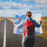
Go on a wayfinding journey
How good are you at finding your way to a completely new place without the help of an Uber? Test your navigation and orientation skills by embarking on a wayfarer's journey. And no, you don’t have to sail across the world to become a wayfarer. Go to busy neighborhoods in your local area that you aren’t familiar with, and see if you could find your way home from them, using landmarks, signs, and maps for help.
Employ wayfinding at work
Are there certain parts of your working environment you wish were easier to navigate, or signs you wished were more properly defined? This month would be the perfect time to take action and bring it up to the board in charge. Make wayfinding easier for you and all your colleagues.
Organize fun wayfinding exercises
Bring friends and family in on the fun by boosting everyone’s wayfinding skills. You can use the first week of the month to organize a fun wayfinding activity such as a treasure hunt and pick when to go on the adventure. Don’t be scared to make it as elaborate and interesting as possible.
5 Important Facts About Maps
The Netherlands' maps
An annual European Fine Art and Antiques Fair in the Netherlands is the best place to shop for maps.
It has fake towns
Mapmakers included fake towns, also known as paper towns, to catch forgers.
The first print
The first modern map was printed in an encyclopedia of world history in 1475.
Inaccurate flat maps
Due to projections and the round nature of the world, it cannot be accurately captured by a flat, small-scale map.
There are two norths
There are two norths that can be found on a map — geographic and geomagnetic.
Why International Wayfinding Month is Important
It highlights the importance of proper direction
Getting proper directions to any destination is essential and makes the entire journey easy and stress-free. This month highlights the importance of proper direction in our everyday lives.
It highlights the importance of wayfinding
Wayfinding is important to us now just as it was to the people of Polynesia back then. It makes navigation easier and helps us find the way to our destinations easily. Wayfinding is an important aspect of our daily lives and this month seeks to highlight that.
It gives us a new skill
Wayfinding principles also rely heavily on our orientation abilities. It goes hand-in-hand with the navigational techniques of wayfinding, and this means things like signage would almost be irrelevant if we did not have the skill of interpretation. Give yourself a round of applause for having such a necessary skill.


Social Media Tips for International Wayfinding Month
Individuals
Creators
Brands