- Today
- Holidays
- Birthdays
- Reminders
- Cities
- Atlanta
- Austin
- Baltimore
- Berwyn
- Beverly Hills
- Birmingham
- Boston
- Brooklyn
- Buffalo
- Charlotte
- Chicago
- Cincinnati
- Cleveland
- Columbus
- Dallas
- Denver
- Detroit
- Fort Worth
- Houston
- Indianapolis
- Knoxville
- Las Vegas
- Los Angeles
- Louisville
- Madison
- Memphis
- Miami
- Milwaukee
- Minneapolis
- Nashville
- New Orleans
- New York
- Omaha
- Orlando
- Philadelphia
- Phoenix
- Pittsburgh
- Portland
- Raleigh
- Richmond
- Rutherford
- Sacramento
- Salt Lake City
- San Antonio
- San Diego
- San Francisco
- San Jose
- Seattle
- Tampa
- Tucson
- Washington
Scientists Uncover Geological History of the Grand Canyon
New research traces the path of the Colorado River over millions of years, revealing how the iconic canyon formed.
Apr. 17, 2026 at 10:10am
Got story updates? Submit your updates here. ›
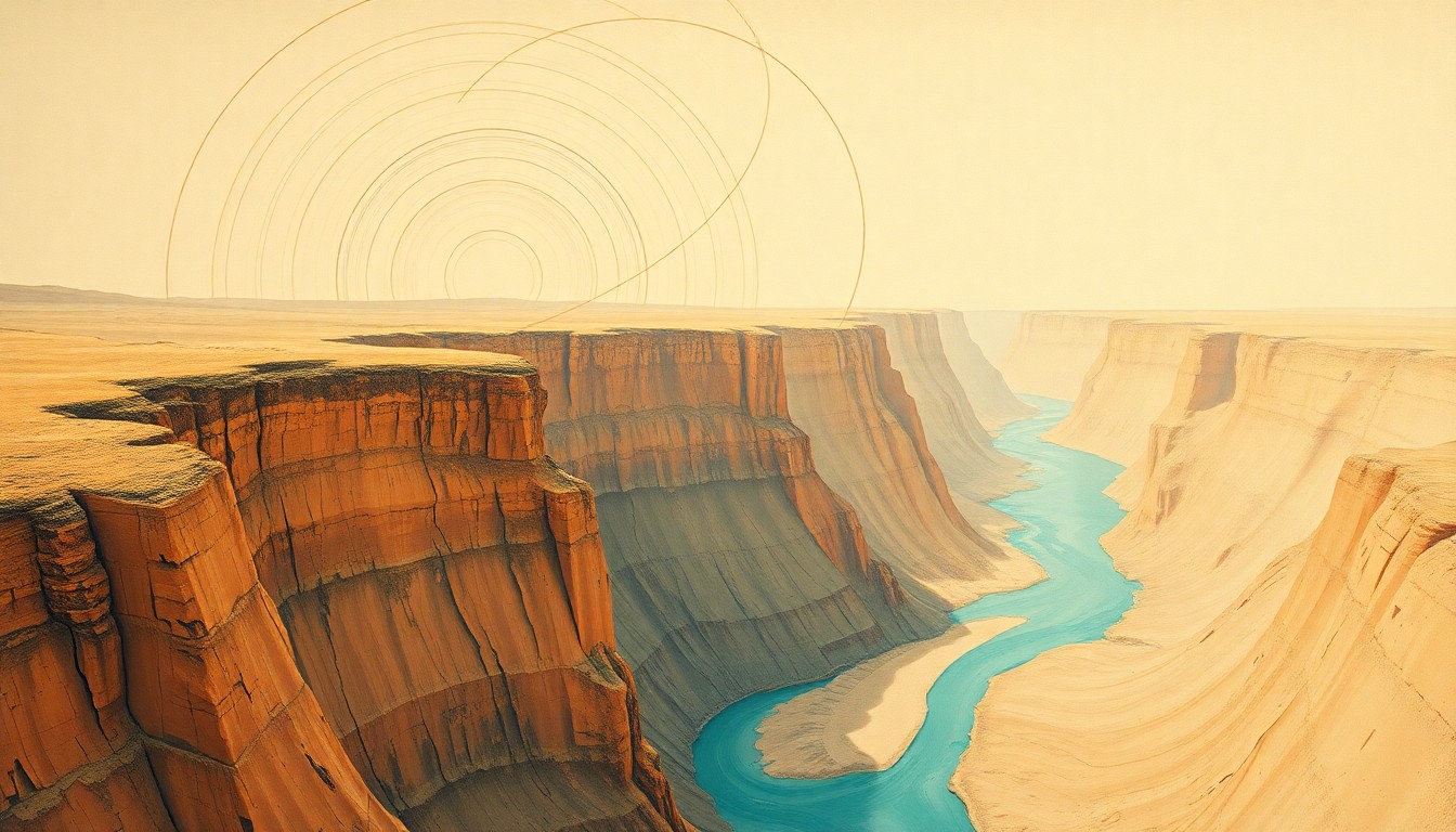 A conceptual illustration of the geological forces and river systems that carved the iconic Grand Canyon over millions of years.Flagstaff Today
Researchers have uncovered new insights into the geological history of the Grand Canyon, tracing the path of the Colorado River over millions of years. By studying zircon crystals and volcanic ash deposits, the scientists were able to determine that the river initially flowed into a large lake in northeastern Arizona around 6.6 million years ago, before eventually spilling over and carving out the Grand Canyon around 5.6 million years ago.
Why it matters
The Grand Canyon is one of the most iconic natural wonders of the world, and understanding its geological history provides important insights into the formation of the American Southwest. This research helps answer longstanding questions about the origins of the Colorado River and how it shaped the dramatic landscape we see today.
The details
The study found that around 6.6 million years ago, the Colorado River began flowing into a large depression in the Earth's surface, called the Bidahochi Basin, forming a wide and shallow lake in northeastern Arizona. Over time, the lake water built up and eventually spilled over a low point on the lakeshore around 5.6 million years ago, sending the river coursing through the region that became the Grand Canyon. The river then filled and spilled through another series of basins downstream, ultimately reaching the Gulf of California about 4.8 million years ago.
- Around 6.6 million years ago, the Colorado River began flowing into the Bidahochi Basin, forming a large lake.
- Around 5.6 million years ago, the lake water spilled over, sending the river through the region that became the Grand Canyon.
- Around 4.8 million years ago, the river reached the Gulf of California in northwestern Mexico.
The players
John He
A geologist at UCLA and co-lead author of the study published in the journal Science.
Ryan Crow
A research geologist at the U.S. Geological Survey in Flagstaff, Arizona, and co-lead author of the study.
What they’re saying
“Imagine you go out to a river bank and scoop up a handful of sand. In that handful, there are hundreds of thousands of sand grains that look like any other sand grain. But within that handful there will be a couple of hundred or even thousands of microscopic grains of zircon crystal, each of which is a vault of information about where it comes from.”
— John He, Geologist, UCLA
“A longstanding question has been: where did the Colorado River go before it flowed through Grand Canyon? We have long known that the river existed in western Colorado 11 million years ago, and that it did not (run through) Grand Canyon until after 5.6 million years ago. But until now we knew almost nothing about where it was during the intervening time.”
— Ryan Crow, Research Geologist, U.S. Geological Survey
What’s next
The researchers say their findings contribute to the ongoing scientific debate about the formation of the Grand Canyon, and they plan to continue studying the geological history of the region to uncover more details about how this natural wonder took shape over millions of years.
The takeaway
This research provides important new insights into the long-term geological processes that shaped one of the world's most iconic natural landscapes, the Grand Canyon. By tracing the path of the Colorado River over millions of years, scientists are gaining a better understanding of how this dramatic feature of the American Southwest came to be.
Flagstaff top stories


Flagstaff events

Apr. 18, 2026
Boots, Scoot and Boogie (18 and Over)
Apr. 23, 2026
Chevelle w/ Dead Poet Society
Apr. 25, 2026
Viola Awards