- Today
- Holidays
- Birthdays
- Reminders
- Cities
- Atlanta
- Austin
- Baltimore
- Berwyn
- Beverly Hills
- Birmingham
- Boston
- Brooklyn
- Buffalo
- Charlotte
- Chicago
- Cincinnati
- Cleveland
- Columbus
- Dallas
- Denver
- Detroit
- Fort Worth
- Houston
- Indianapolis
- Knoxville
- Las Vegas
- Los Angeles
- Louisville
- Madison
- Memphis
- Miami
- Milwaukee
- Minneapolis
- Nashville
- New Orleans
- New York
- Omaha
- Orlando
- Philadelphia
- Phoenix
- Pittsburgh
- Portland
- Raleigh
- Richmond
- Rutherford
- Sacramento
- Salt Lake City
- San Antonio
- San Diego
- San Francisco
- San Jose
- Seattle
- Tampa
- Tucson
- Washington
Casper Today
By the People, for the People
Casper Braces for Rapid Warm-Up and Elevated Fire Risk
Freeze warning in effect until morning, followed by sunny skies and gusty winds that could fuel wildfires
Apr. 18, 2026 at 1:34pm
Got story updates? Submit your updates here. ›
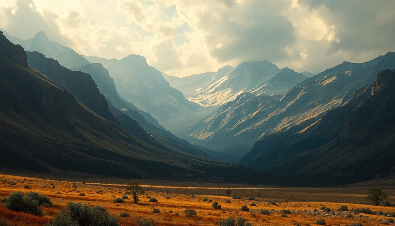 The sweeping, atmospheric grandeur of the Rockies underscores the power of nature and the need for vigilance as Casper braces for elevated fire risks.Casper Today
A cold start to the day in Casper, Wyoming will give way to a steady warming trend and rising fire concerns through the early part of next week. A freeze warning remains in effect until 9 a.m. today, but temperatures are expected to climb into the 50s under sunny skies. Breezy west winds and low humidity will create elevated fire weather conditions this afternoon, particularly in areas that saw recent snowfall. Temperatures are forecast to reach the 60s by Sunday and the 80s by Tuesday, maintaining high fire risks each afternoon despite relatively light winds.
Why it matters
Rapid temperature swings and dry, windy conditions can quickly turn small fires into major threats in the Casper area, which has experienced an increase in wildfire activity in recent years. Residents and officials will need to remain vigilant about fire prevention and preparedness as the weather patterns shift.
The details
The National Weather Service has issued a freeze warning for the Green Mountains, Rattlesnake Range, and lower elevations of Natrona County until 9 a.m. today, with overnight lows dropping into the mid- to upper teens. Once the morning chill lifts, the Casper area will see sunny skies with a high near 53 degrees. Breezy west winds between 9 and 18 mph, with gusts up to 28 mph, combined with low humidity will create elevated fire weather conditions this afternoon.
- A freeze warning remains in effect until 9 a.m. today.
- Temperatures are expected to reach a high near 53 degrees today.
- Sunny skies and breezy winds up to 28 mph are forecast for this afternoon.
- Temperatures will continue climbing, reaching 67 degrees on Sunday and 80 degrees by Tuesday.
- A shift in the weather pattern is likely by midweek, with a chance of rain and snow showers on Thursday.
The players
National Weather Service
The federal agency responsible for weather forecasting and issuing warnings for the Casper area.
What they’re saying
“A freeze warning remains in effect until 9 a.m. today for the Green Mountains, the Rattlesnake Range and lower elevations of Natrona County. Meteorologists with the National Weather Service in Riverton reported overnight temperatures dropped into the mid- to upper teens. That's cold enough to damage unprotected outdoor plumbing and kill sensitive vegetation, they said.”
— National Weather Service, Meteorologists
What’s next
The National Weather Service will continue to monitor the situation and issue updates on the evolving fire risk and potential for precipitation later in the week.
The takeaway
The rapid shift from freeze warnings to elevated fire danger in Casper highlights the need for residents and officials to stay vigilant about fire prevention and preparedness as the weather patterns change. Maintaining awareness of the latest forecasts and taking appropriate precautions will be crucial in the coming days.