- Today
- Holidays
- Birthdays
- Reminders
- Cities
- Atlanta
- Austin
- Baltimore
- Berwyn
- Beverly Hills
- Birmingham
- Boston
- Brooklyn
- Buffalo
- Charlotte
- Chicago
- Cincinnati
- Cleveland
- Columbus
- Dallas
- Denver
- Detroit
- Fort Worth
- Houston
- Indianapolis
- Knoxville
- Las Vegas
- Los Angeles
- Louisville
- Madison
- Memphis
- Miami
- Milwaukee
- Minneapolis
- Nashville
- New Orleans
- New York
- Omaha
- Orlando
- Philadelphia
- Phoenix
- Pittsburgh
- Portland
- Raleigh
- Richmond
- Rutherford
- Sacramento
- Salt Lake City
- San Antonio
- San Diego
- San Francisco
- San Jose
- Seattle
- Tampa
- Tucson
- Washington
Spokane Braces for 3-Day Mountain Snow Event
Hazardous travel conditions expected on I-90 and Cascade passes starting Tuesday
Apr. 13, 2026 at 5:24pm
Got story updates? Submit your updates here. ›
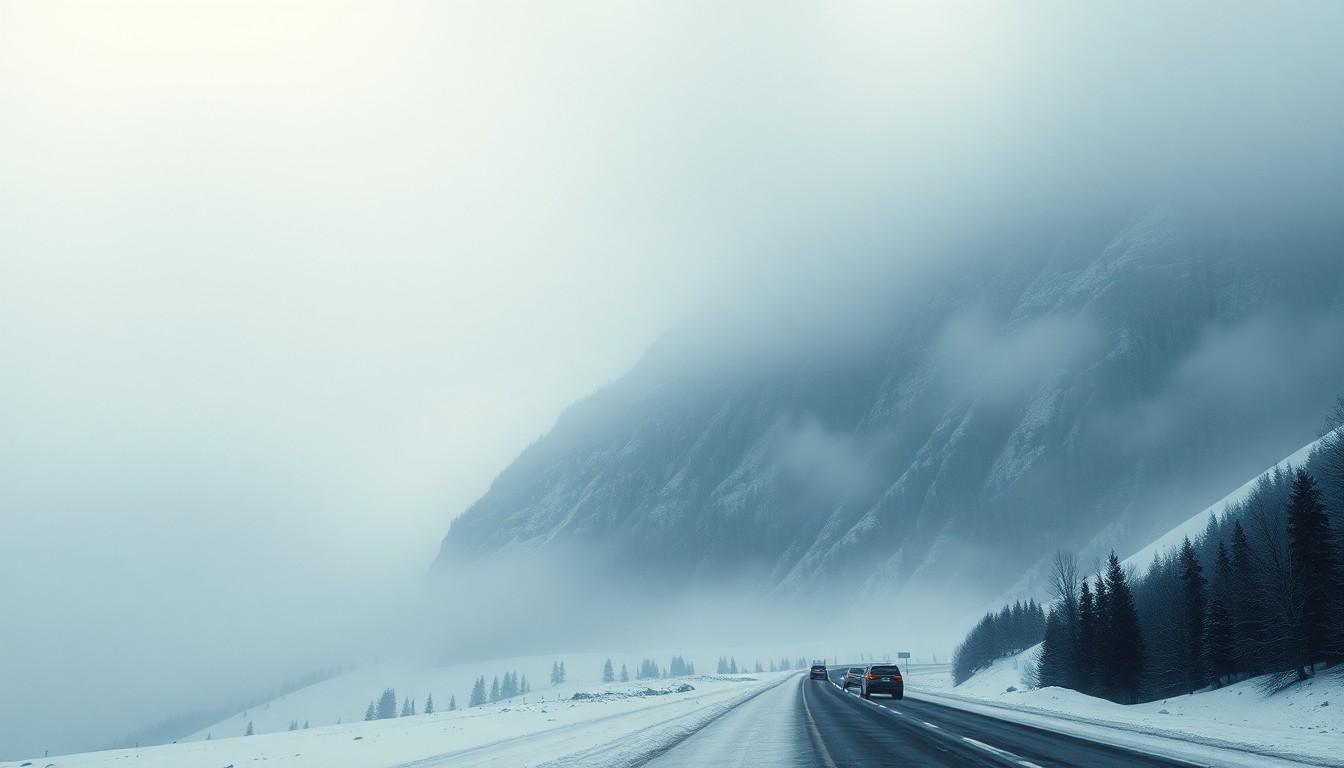 A looming winter storm threatens to engulf the mountain passes around Spokane, Washington, posing hazards for travelers.Spokane Today
A multi-day winter storm system is set to bring heavy snow to the mountain passes around Spokane, Washington, starting on Tuesday afternoon and lasting through Friday. Drivers crossing the Cascades and northern Idaho mountains could face reduced visibility, snow-covered lanes, and quickly deteriorating conditions, especially during peak travel times.
Why it matters
The impending snowstorm poses significant risks for travelers in the region, with the potential to create hazardous driving conditions on major highways like I-90 and US-2. The weather event could disrupt commutes and delay essential travel, underscoring the importance of preparedness and safety for residents and visitors.
The details
According to the National Weather Service in Spokane, snow will begin across the Cascades around 12 p.m. on Tuesday, intensifying through Wednesday night. Northern Idaho mountains will also see snow develop on Tuesday afternoon, with impacts lasting into Friday afternoon. Stevens Pass, Snoqualmie Pass, and Lookout Pass are expected to be the most heavily affected, with reduced visibility and snow-covered lanes likely during peak travel periods.
- Snow will begin in the Cascades around 12 p.m. on Tuesday, April 15, 2026.
- Snow will develop in the northern Idaho mountains on Tuesday afternoon, April 15, 2026.
- The snowstorm is expected to last through Friday afternoon, April 18, 2026.
The players
National Weather Service in Spokane
The local office of the National Weather Service that issued the forecast and weather alerts for the Spokane region.
Washington State Department of Transportation (WSDOT)
The state agency responsible for maintaining and monitoring road conditions on major highways like I-90 and US-2 in the Spokane area.
What they’re saying
“Travelers should delay non-essential trips through mountain corridors, carry tire chains, and check WSDOT pass reports before departure. Conditions may shift quickly with elevation.”
— National Weather Service in Spokane
What’s next
The National Weather Service and WSDOT will continue to monitor the storm and provide updates on road conditions and travel advisories as the system evolves over the next few days.
The takeaway
This multi-day snowstorm is a reminder of the importance of winter weather preparedness and safety for drivers in the Spokane region. Heeding weather warnings, checking road conditions, and adjusting travel plans accordingly can help prevent accidents and delays during hazardous winter driving conditions.