- Today
- Holidays
- Birthdays
- Reminders
- Cities
- Atlanta
- Austin
- Baltimore
- Berwyn
- Beverly Hills
- Birmingham
- Boston
- Brooklyn
- Buffalo
- Charlotte
- Chicago
- Cincinnati
- Cleveland
- Columbus
- Dallas
- Denver
- Detroit
- Fort Worth
- Houston
- Indianapolis
- Knoxville
- Las Vegas
- Los Angeles
- Louisville
- Madison
- Memphis
- Miami
- Milwaukee
- Minneapolis
- Nashville
- New Orleans
- New York
- Omaha
- Orlando
- Philadelphia
- Phoenix
- Pittsburgh
- Portland
- Raleigh
- Richmond
- Rutherford
- Sacramento
- Salt Lake City
- San Antonio
- San Diego
- San Francisco
- San Jose
- Seattle
- Tampa
- Tucson
- Washington
Everson Today
By the People, for the People
Cross-Border Flooding Exposes Challenges of Shared Watersheds
Extreme weather events highlight the need for coordinated flood management across political boundaries.
Apr. 11, 2026 at 7:36am
Got story updates? Submit your updates here. ›
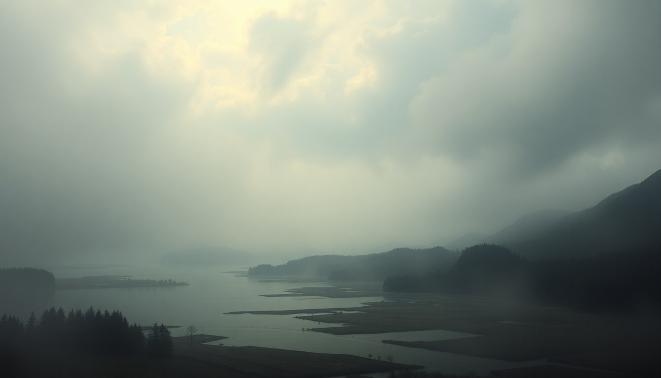 As climate change amplifies the frequency and intensity of extreme weather events, the cross-border flooding in the Nooksack/Sumas watershed serves as a sobering reminder of the need for coordinated, regional approaches to flood management.Everson Today
Severe flooding in the Nooksack River watershed, which spans the border between Washington state and British Columbia, has exposed the complex challenges of managing shared waterways and floodplains that cross jurisdictional lines. The article explores how historical land use decisions, development patterns, and a lack of cross-border coordination have contributed to the flooding issues, and calls for a broader regional approach to flood risk management that aligns incentives and responsibilities across political boundaries.
Why it matters
The cross-border flooding in the Nooksack/Sumas watershed is a microcosm of a broader issue facing many regions where rivers, watersheds, and floodplains do not respect political borders. As extreme weather events become more frequent due to climate change, the need for coordinated, multi-jurisdictional approaches to flood management is becoming increasingly urgent. This story highlights the consequences of siloed decision-making and the importance of regional planning to address shared environmental challenges.
The details
The Nooksack River, which originates in Washington state's North Cascades, flows north into the Sumas River in British Columbia. When the Nooksack floods, water often spills across the border into the Sumas watershed. This is due in part to historical decisions made in the 1920s to dike and drain the Sumas Prairie, which was formerly a lake, to create farmland. This has left the area more vulnerable to flooding, as the natural floodplain has been developed. Efforts to address the cross-border flooding issues have been sporadic, with some modeling and proposals made after the severe floods of 1990, but little sustained action. The challenge is that potential solutions to help one side of the border could exacerbate problems elsewhere, requiring a more holistic, regional approach.
- In the 1920s, the Sumas Prairie, a former glacial lake, was diked and drained to create farmland.
- After the severe flooding of 1990, a cross-border effort was formed to explore flood mitigation options, but activity faded around 2011.
- The cross-border flooding effort was revived after the 2021 floods.
The players
Nooksack River
A river that originates in Washington state's North Cascades and flows north into the Sumas River in British Columbia.
Sumas River
A river in British Columbia that receives overflow from the Nooksack River during major flood events.
Sumas Prairie
A former glacial lake that was diked and drained in the 1920s to create farmland, leaving the area more vulnerable to flooding.
International Joint Commission (IJC)
A binational organization formed under the 1909 Boundary Waters Treaty to study and propose solutions for flooding in shared waterways, such as the Lake Champlain–Richelieu River basin.
Abbotsford Mayor
The mayor of Abbotsford, British Columbia, who has been vocal about federal inaction and strained cross-border coordination in addressing the recent flooding.
What’s next
The International Joint Commission (IJC) is expected to continue studying the cross-border flooding issues in the Nooksack/Sumas watershed and potentially propose solutions, building on past efforts and lessons learned from other shared waterway challenges, such as the Lake Champlain–Richelieu River basin.
The takeaway
The cross-border flooding in the Nooksack/Sumas watershed highlights the need for a more coordinated, regional approach to flood management that transcends political boundaries. As extreme weather events become more frequent, communities must work together across jurisdictions to develop comprehensive solutions that address the shared environmental challenges of shared waterways and floodplains.