- Today
- Holidays
- Birthdays
- Reminders
- Cities
- Atlanta
- Austin
- Baltimore
- Berwyn
- Beverly Hills
- Birmingham
- Boston
- Brooklyn
- Buffalo
- Charlotte
- Chicago
- Cincinnati
- Cleveland
- Columbus
- Dallas
- Denver
- Detroit
- Fort Worth
- Houston
- Indianapolis
- Knoxville
- Las Vegas
- Los Angeles
- Louisville
- Madison
- Memphis
- Miami
- Milwaukee
- Minneapolis
- Nashville
- New Orleans
- New York
- Omaha
- Orlando
- Philadelphia
- Phoenix
- Pittsburgh
- Portland
- Raleigh
- Richmond
- Rutherford
- Sacramento
- Salt Lake City
- San Antonio
- San Diego
- San Francisco
- San Jose
- Seattle
- Tampa
- Tucson
- Washington
Severe Storms and Unseasonable Cold Forecast for Western New York
Saturday to bring warm temperatures and potential for severe thunderstorms, followed by a dramatic temperature drop on Sunday.
Apr. 18, 2026 at 10:24am
Got story updates? Submit your updates here. ›
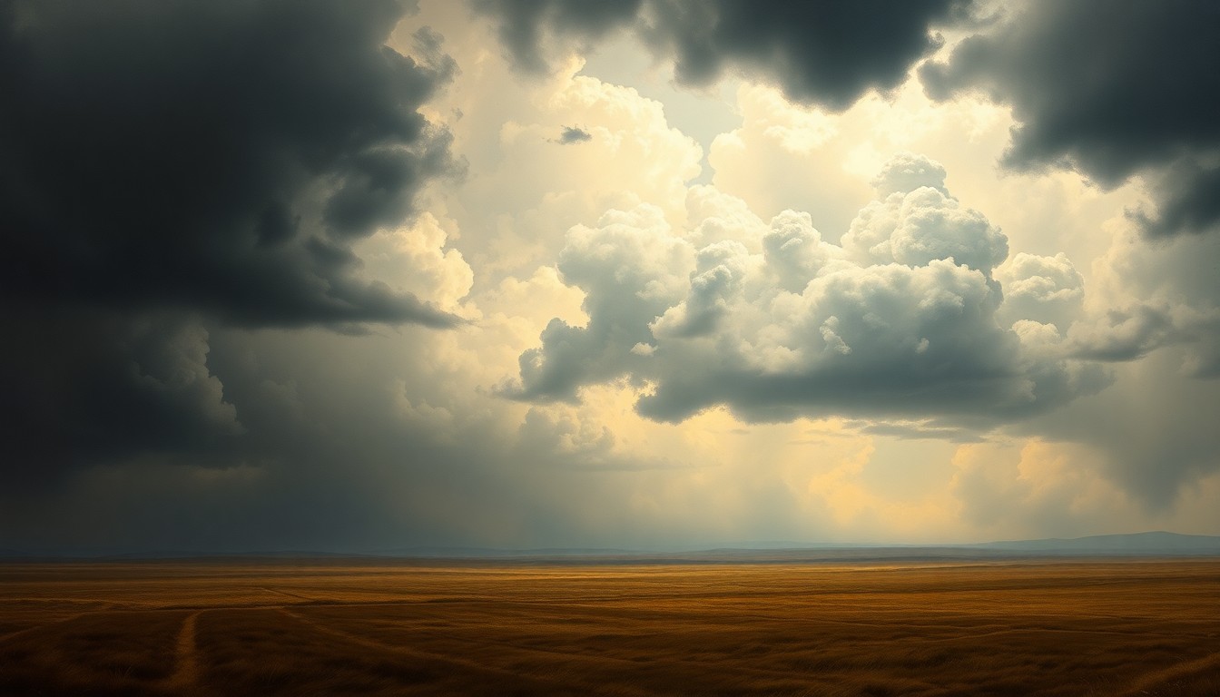 As a dramatic weather shift sweeps across Western New York, the region braces for the unpredictable forces of nature.Buffalo Today
Western New York is bracing for a split-screen weather weekend, with warm conditions and the threat of severe storms on Saturday, followed by an abrupt plunge into unseasonably cold temperatures on Sunday. The National Weather Service is warning of the potential for strong thunderstorms, flash flooding, and even wet snow as the region experiences a dramatic weather shift.
Why it matters
The volatile weather pattern could disrupt outdoor activities, impact travel, and pose risks to public safety, especially if severe storms materialize. The dramatic temperature swing from warm to cold also highlights the unpredictable nature of spring weather in the region.
The details
Saturday is expected to see high temperatures in the mid to upper 70s across Western New York, with showers and thunderstorms strengthening as they move into the area, particularly between 2 p.m. and 8 p.m. Much of the region south of the New York State Thruway is under a slight to marginal risk for severe weather. The storms could result in ponding and isolated flash flooding due to the saturated ground. However, the showers and storms will quickly move out Saturday evening, leading to a dramatic temperature drop.
- Temperatures will reach the mid to upper 70s on Saturday afternoon.
- Severe thunderstorms are expected between 2 p.m. and 8 p.m. on Saturday.
- Temperatures will plummet into the 30s by Sunday morning.
- Low temperatures are forecast to reach the upper 20s across the region on Sunday night.
The players
Phillip Pandolfo
A meteorologist with the National Weather Service.
National Weather Service
The federal agency responsible for weather forecasting and issuing weather-related warnings.
What they’re saying
“We're expecting temperatures to be even warmer than they were yesterday. Today will be the very last day of the very warm pattern that we've been in.”
— Phillip Pandolfo, Meteorologist
“We're tracking an area of showers and embedded thunderstorms ...that'll make its way into our area here today, we are expecting these showers and storms to strengthen as they get into our area.”
— Phillip Pandolfo, Meteorologist
“By tomorrow evening across all of WNY, we're going to be seeing temperatures tumbling down through the 30's. By tomorrow night, we're going to be seeing low temperatures actually in the upper 20's across the entire area.”
— Phillip Pandolfo, Meteorologist
What’s next
The National Weather Service will continue to monitor the developing weather situation and issue any necessary severe weather watches or warnings for the region.
The takeaway
This weekend's weather pattern highlights the unpredictable nature of spring in Western New York, with the potential for severe storms and dramatic temperature swings. Residents should stay vigilant, heed any weather warnings, and be prepared for rapidly changing conditions.
Buffalo top stories


Buffalo events

Apr. 18, 2026
Jesus Christ Superstar
Apr. 18, 2026
Moon Walker's Wasteland Country Tour
Apr. 18, 2026
Water for Elephants (Touring)