- Today
- Holidays
- Birthdays
- Reminders
- Cities
- Atlanta
- Austin
- Baltimore
- Berwyn
- Beverly Hills
- Birmingham
- Boston
- Brooklyn
- Buffalo
- Charlotte
- Chicago
- Cincinnati
- Cleveland
- Columbus
- Dallas
- Denver
- Detroit
- Fort Worth
- Houston
- Indianapolis
- Knoxville
- Las Vegas
- Los Angeles
- Louisville
- Madison
- Memphis
- Miami
- Milwaukee
- Minneapolis
- Nashville
- New Orleans
- New York
- Omaha
- Orlando
- Philadelphia
- Phoenix
- Pittsburgh
- Portland
- Raleigh
- Richmond
- Rutherford
- Sacramento
- Salt Lake City
- San Antonio
- San Diego
- San Francisco
- San Jose
- Seattle
- Tampa
- Tucson
- Washington
Tornado and Flood Threat Impact Northern Illinois
Severe storms bring tornado risk and rising flood concerns to northern Illinois, including Rockford and surrounding communities.
Apr. 16, 2026 at 1:53am
Got story updates? Submit your updates here. ›
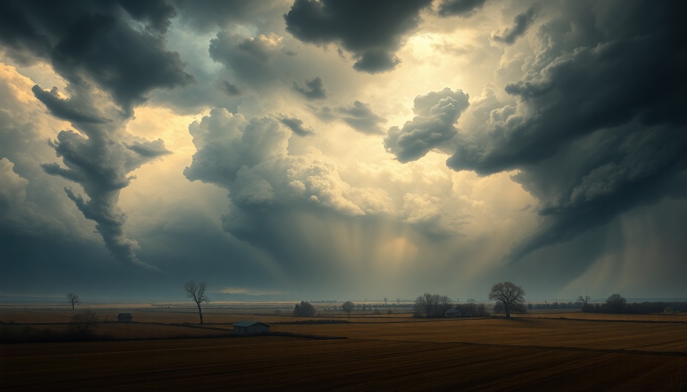
 The ominous approach of a powerful storm system casts an eerie, foreboding shadow over the Rockford region.Rockford Today
A fast-moving storm system triggered tornado sirens across the Rockford region for the second consecutive night, with severe thunderstorms expected to continue until late Wednesday night. The National Weather Service had a Tornado Warning in effect until 8:30 pm for north central Ogle County and southwestern Winnebago County, with radar indicating a rotating storm near German Valley around 8:11 pm. A Tornado Watch remains in effect until 10 pm CDT for portions of northwest Illinois, along the border with Iowa. A Flash Flood Warning has also been issued for Boone County and Winnebago County until 2:30 am on Thursday, with rainfall of 1 to 2 inches per hour possible during the storm. Beyond the immediate storm threat, officials are also monitoring rising water levels along the Rock River, with a Flood Watch set to begin on Thursday afternoon (4/16) as water levels are expected to approach or exceed flood stage.
Why it matters
The severe weather system poses a significant threat to public safety in the Rockford region, with the potential for damaging winds, large hail, isolated tornadoes, and flash flooding. The rising flood risk along the Rock River also raises concerns about property damage and potential closures in low-lying areas near the river.
The details
The National Weather Service had a Tornado Warning in effect until 8:30 pm for north central Ogle County and southwestern Winnebago County, with radar indicating a rotating storm near German Valley around 8:11 pm. A Tornado Watch remains in effect until 10 pm CDT for portions of northwest Illinois, along the border with Iowa. A Flash Flood Warning has also been issued for Boone County and Winnebago County until 2:30 am on Thursday, with rainfall of 1 to 2 inches per hour possible during the storm. Beyond the immediate storm threat, officials are also monitoring rising water levels along the Rock River, with a Flood Watch set to begin on Thursday afternoon (4/16) as water levels are expected to approach or exceed flood stage.
- A Tornado Warning was in effect until 8:30 pm on Wednesday, April 15, 2026.
- A Tornado Watch remains in effect until 10 pm CDT on Wednesday, April 15, 2026.
- A Flash Flood Warning has been issued for Boone County and Winnebago County until 2:30 am on Thursday, April 16, 2026.
- A Flood Watch is set to begin on Thursday afternoon, April 16, 2026.
The players
National Weather Service
The federal agency responsible for weather forecasting and issuing severe weather alerts.
What’s next
The National Weather Service will continue to monitor the storm system and provide updates on the tornado and flood risks throughout the night and into Thursday.
The takeaway
The severe weather system poses a significant threat to public safety in the Rockford region, with the potential for damaging winds, large hail, isolated tornadoes, and flash flooding. Residents are urged to stay vigilant, heed all weather warnings, and take shelter in the safest locations to protect themselves from the dangerous conditions.
Rockford top stories


Rockford events

Apr. 18, 2026
Rockford Symphony Orchestra: From Fate To Triumph

Apr. 19, 2026
Queensrÿche