- Today
- Holidays
- Birthdays
- Reminders
- Cities
- Atlanta
- Austin
- Baltimore
- Berwyn
- Beverly Hills
- Birmingham
- Boston
- Brooklyn
- Buffalo
- Charlotte
- Chicago
- Cincinnati
- Cleveland
- Columbus
- Dallas
- Denver
- Detroit
- Fort Worth
- Houston
- Indianapolis
- Knoxville
- Las Vegas
- Los Angeles
- Louisville
- Madison
- Memphis
- Miami
- Milwaukee
- Minneapolis
- Nashville
- New Orleans
- New York
- Omaha
- Orlando
- Philadelphia
- Phoenix
- Pittsburgh
- Portland
- Raleigh
- Richmond
- Rutherford
- Sacramento
- Salt Lake City
- San Antonio
- San Diego
- San Francisco
- San Jose
- Seattle
- Tampa
- Tucson
- Washington
Colorado Mountains Brace for Back-to-Back April Snowstorms
Ski resorts and mountain towns could see up to 16 inches of snow over the next week.
Mar. 31, 2026 at 10:23am
Got story updates? Submit your updates here. ›
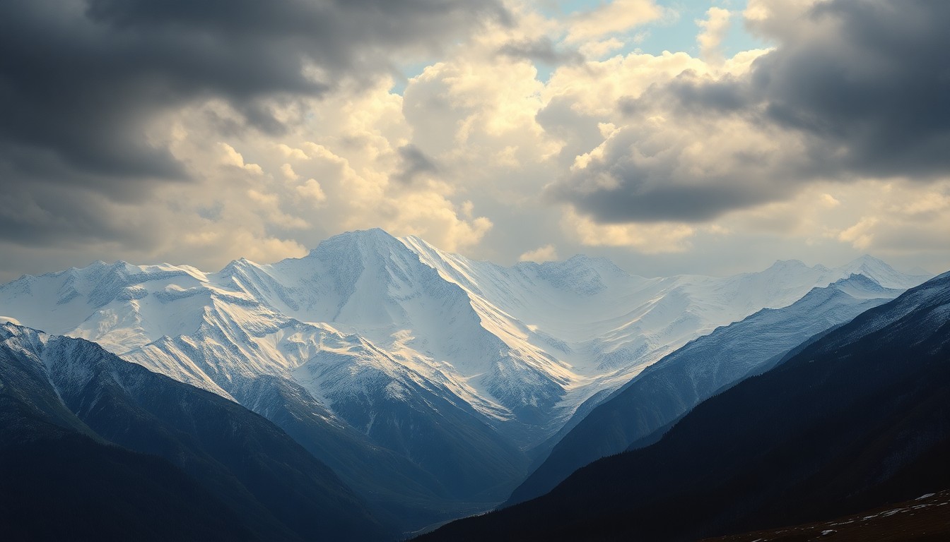 As Colorado's mountain communities brace for a series of late-season snowstorms, the state's depleted snowpack highlights the region's vulnerability to the impacts of climate change.Aspen Today
Two April storms are expected to bring significant snowfall to Colorado's northern and central mountain regions, following record-breaking warm temperatures in late March that created critical fire weather conditions. The first storm will arrive on Tuesday night, with the central and southern mountains potentially seeing up to 16 inches of snow, while northern resorts like Vail and Breckenridge could get 3-8 inches. A second storm is forecast for Thursday night through Saturday, though it will be drier, with 3-10 inches of snow expected.
Why it matters
Colorado's snowpack is currently well below average for this time of year, so the upcoming snowstorms could provide a much-needed boost to the state's water supply and ski season. However, the rapid temperature swings and thin snowpack could also create hazardous travel conditions and challenges for mountain communities.
The details
The first storm will bring snow or rain to several Western Slope counties from Tuesday night through Thursday morning. Central and southern mountain resorts like Purgatory and Aspen could see 8-16 inches of snow, while northern resorts like Vail, Breckenridge, and Winter Park are expected to get 3-8 inches. The snow/rain line will likely be around 8,000 feet, meaning lower elevation valleys could see more rain. A winter weather advisory warns of gusty winds up to 40 mph, which could impact travel on some mountain passes. The second storm from Thursday night to Saturday morning will be drier, with 3-10 inches of snow expected across the northern and central mountains.
- On Monday, several Western Slope counties received red flag warnings due to a combination of strong winds and record-breaking warm temperatures between 50 and 70 degrees.
- The first storm will arrive on Tuesday night and continue through Thursday morning.
- The second storm will deliver snow and colder temperatures from Thursday night to Saturday morning.
The players
OpenSnow
A weather forecasting service that provided the snow accumulation predictions for the upcoming storms.
National Weather Service
The government agency that issued the winter weather advisory for the mountain towns.
What they’re saying
“'It'll look more like winter on Wednesday and feel more like winter on Friday into Saturday with colder temperatures. But our base is decimated in most areas, so ride carefully and remember that it might be pretty darn thin under this week's new snow.'”
— Joel Gratz, Founding Meteorologist, OpenSnow
What’s next
Another storm could be possible around April 8-10, according to OpenSnow, though it's too early to tell. In the meantime, Colorado's well-below-average snowpack has fallen to 24% of the median for March 30.
The takeaway
The upcoming snowstorms could provide a much-needed boost to Colorado's depleted snowpack and ski season, but the rapid temperature swings and thin base could also create hazardous travel conditions and challenges for mountain communities.