- Today
- Holidays
- Birthdays
- Reminders
- Cities
- Atlanta
- Austin
- Baltimore
- Berwyn
- Beverly Hills
- Birmingham
- Boston
- Brooklyn
- Buffalo
- Charlotte
- Chicago
- Cincinnati
- Cleveland
- Columbus
- Dallas
- Denver
- Detroit
- Fort Worth
- Houston
- Indianapolis
- Knoxville
- Las Vegas
- Los Angeles
- Louisville
- Madison
- Memphis
- Miami
- Milwaukee
- Minneapolis
- Nashville
- New Orleans
- New York
- Omaha
- Orlando
- Philadelphia
- Phoenix
- Pittsburgh
- Portland
- Raleigh
- Richmond
- Rutherford
- Sacramento
- Salt Lake City
- San Antonio
- San Diego
- San Francisco
- San Jose
- Seattle
- Tampa
- Tucson
- Washington
Sacramento Braces for Three-Day Storm
Valley rain, Sierra snow, and possible thunderstorms expected Monday through Wednesday
Apr. 19, 2026 at 4:07pm
Got story updates? Submit your updates here. ›
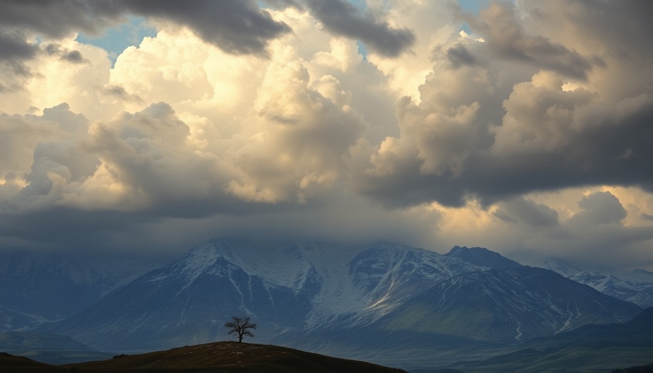 The approaching storm system promises to unleash the raw, sublime power of nature across the Sacramento region.Today in Sacramento
A storm system is forecast to move into the Sacramento region on Monday, April 20, and linger through Wednesday, April 22, bringing valley rain, mountain snow, and a higher chance of thunderstorms. Initial valley rainfall totals are expected to be modest, around 0.1 to 0.25 inches on Monday, while the foothills could pick up around 1.5-3 inches. In the higher Sierra, forecasts call for about 1-2 feet of snow. The greatest threat for thunderstorms comes on Tuesday, with cooler daytime highs in the low 60s.
Why it matters
The incoming storm system is expected to bring significant travel impacts, including reduced visibility, temporary road restrictions, and slower commutes due to the mix of wind and rain. Residents and travelers should be prepared for potential delays and disruptions, especially those planning trips to the Sierra Nevada mountains.
The details
The storm is forecast to reach the Sacramento valley on Monday afternoon, with rain chances increasing after 11 a.m. and becoming more likely Monday night into Tuesday. Snow levels are expected to start out relatively high on Monday, around 6,000-7,000 feet, then drop to about 5,000-6,000 feet late Tuesday into Wednesday, increasing the odds of chain controls and slower travel across Sierra passes. Southerly winds will strengthen from Sunday into Monday ahead of the storm system, with foothill and mountain locations potentially seeing gusts around 25-30 mph.
- The storm system is forecast to move into the Sacramento region on Monday, April 20.
- Rain chances are expected to increase after 11 a.m. on Monday, April 20, and become more likely Monday night into Tuesday, April 21.
- The greatest threat for thunderstorms is expected on Tuesday, April 21, with cooler daytime highs in the low 60s.
- Snow levels are expected to start out around 6,000-7,000 feet on Monday, April 20, then drop to about 5,000-6,000 feet late Tuesday, April 21, into Wednesday, April 22.
The players
National Weather Service Sacramento
The National Weather Service office responsible for providing weather forecasts and warnings for the Sacramento region.
What’s next
Residents and travelers should check current road conditions and chain requirements on Caltrans QuickMap before heading into the Sierra Nevada mountains. Transit riders and motorists should also be prepared for slower speeds and occasional service impacts when the rain or any thunderstorms pick up.
The takeaway
The incoming storm system is expected to bring significant travel impacts, including reduced visibility, temporary road restrictions, and slower commutes due to the mix of wind and rain. Residents and travelers should be prepared for potential delays and disruptions, especially those planning trips to the Sierra Nevada mountains.
Sacramento top stories


Sacramento events

Apr. 20, 2026
Dazed and Confused
Apr. 21, 2026
Dancing With The Stars: Live! - 2026 Tour
Apr. 21, 2026
Masood Boomgaard