- Today
- Holidays
- Birthdays
- Reminders
- Cities
- Atlanta
- Austin
- Baltimore
- Berwyn
- Beverly Hills
- Birmingham
- Boston
- Brooklyn
- Buffalo
- Charlotte
- Chicago
- Cincinnati
- Cleveland
- Columbus
- Dallas
- Denver
- Detroit
- Fort Worth
- Houston
- Indianapolis
- Knoxville
- Las Vegas
- Los Angeles
- Louisville
- Madison
- Memphis
- Miami
- Milwaukee
- Minneapolis
- Nashville
- New Orleans
- New York
- Omaha
- Orlando
- Philadelphia
- Phoenix
- Pittsburgh
- Portland
- Raleigh
- Richmond
- Rutherford
- Sacramento
- Salt Lake City
- San Antonio
- San Diego
- San Francisco
- San Jose
- Seattle
- Tampa
- Tucson
- Washington
Eureka Today
By the People, for the People
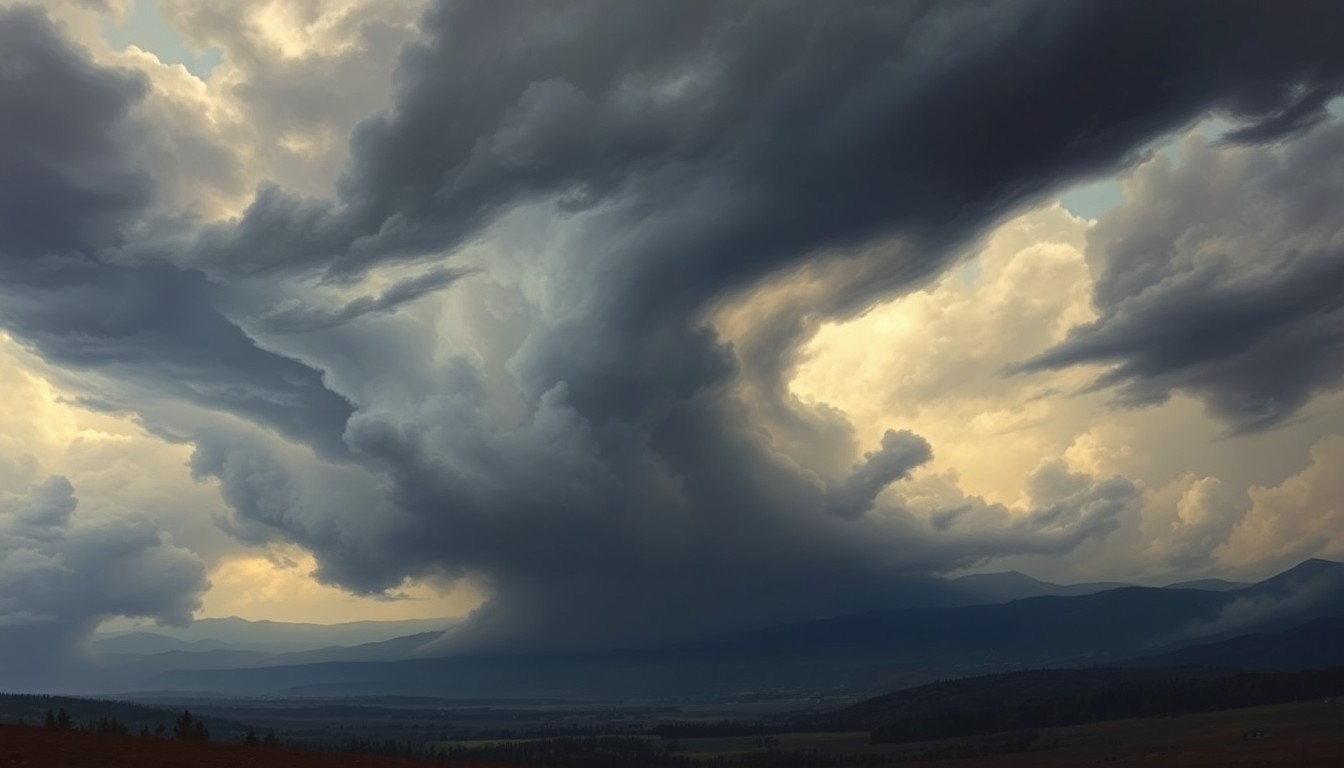
Northern California Faces Thunderstorm Risk Thursday
Heavy rain, lightning, and slick roads expected across interior counties
Apr. 6, 2026 at 10:34pm
Got story updates? Submit your updates here. ›
 A looming storm system threatens to unleash heavy rain, thunderstorms, and hazardous travel conditions across Northern California's interior regions.Eureka Today
A storm system is set to bring heavy rain, thunderstorms, and hazardous travel conditions to Northern California's interior regions on Thursday. The National Weather Service has issued alerts for a 65% chance of rain and isolated thunderstorms across Humboldt, Del Norte, and Trinity counties, with the highest risk between 2 p.m. and 8 p.m. Coastal areas like Eureka and Crescent City will see steadier light rain, though a chance of thunderstorms offshore remains. Drivers along major highways should prepare for reduced visibility and slick conditions.
Why it matters
Thunderstorms can bring dangerous conditions like heavy downpours, lightning, and flash flooding that can disrupt travel and outdoor activities. This storm system has the potential to impact commutes, outdoor plans, and even cause minor infrastructure damage in the affected regions.
The details
According to the National Weather Service, rain chances will climb from 30% on Wednesday morning to as high as 65% by Thursday afternoon across Humboldt, Del Norte, and Trinity counties. Thunderstorms are most likely to develop inland, including areas near Willow Creek, Weaverville, and Trinity Center, especially between 2 p.m. and 8 p.m. Coastal cities like Eureka, Crescent City, and Fort Bragg will see steadier light rain, though a 10% to 15% chance of thunderstorms could still develop over coastal waters and briefly move onshore late Thursday into Friday. Drivers along U.S. Highway 101 and State Route 299 should prepare for reduced visibility and slick conditions during heavier bursts of rain.
- Rain chances climb from 30% on Wednesday morning to 65% by Thursday afternoon.
- Thunderstorms are most likely to develop inland between 2 p.m. and 8 p.m. on Thursday.
- Coastal areas will see steadier light rain, with a 10-15% chance of thunderstorms late Thursday into Friday.
The players
National Weather Service
The federal agency responsible for weather forecasting and issuing alerts in the United States.
What’s next
Residents should secure loose outdoor items, allow extra travel time, and avoid exposed ridgelines during thunderstorms. Additional weather updates are expected as the storm timing becomes clearer through Friday.
The takeaway
This storm system has the potential to create hazardous travel conditions and disrupt outdoor activities across Northern California's interior regions on Thursday. Residents should prepare for heavy rain, thunderstorms, and slick roads, especially along major highways.