- Today
- Holidays
- Birthdays
- Reminders
- Cities
- Atlanta
- Austin
- Baltimore
- Berwyn
- Beverly Hills
- Birmingham
- Boston
- Brooklyn
- Buffalo
- Charlotte
- Chicago
- Cincinnati
- Cleveland
- Columbus
- Dallas
- Denver
- Detroit
- Fort Worth
- Houston
- Indianapolis
- Knoxville
- Las Vegas
- Los Angeles
- Louisville
- Madison
- Memphis
- Miami
- Milwaukee
- Minneapolis
- Nashville
- New Orleans
- New York
- Omaha
- Orlando
- Philadelphia
- Phoenix
- Pittsburgh
- Portland
- Raleigh
- Richmond
- Rutherford
- Sacramento
- Salt Lake City
- San Antonio
- San Diego
- San Francisco
- San Jose
- Seattle
- Tampa
- Tucson
- Washington
Freeze Warnings and Fire Danger Across West Virginia
Plummeting temperatures and dry conditions create risks for crops, pipes, and wildfires through midweek
Apr. 6, 2026 at 10:33pm
Got story updates? Submit your updates here. ›
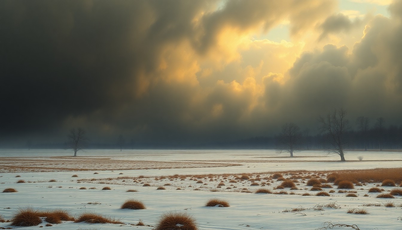 The impending freeze and fire risk across West Virginia's Appalachian region underscore the raw power and unpredictability of the natural world.Charleston Today
A freeze warning is in effect across West Virginia, with overnight lows expected to dip into the 20s and low 30s, putting crops, outdoor plumbing, and early-season vegetation at risk. Additionally, dry air and breezy winds are elevating fire danger statewide, especially during peak afternoon hours. The freeze and fire risks are expected to continue through midweek before a warming trend arrives by the end of the week.
Why it matters
Sudden freezing temperatures can cause significant damage to crops, irrigation systems, and other sensitive outdoor infrastructure across the Appalachian region. Meanwhile, the combination of low humidity and gusty winds raises the threat of wildfires, which can quickly spread and threaten homes and businesses if not contained quickly.
The details
According to the National Weather Service in Charleston, a Freeze Warning remains in effect from 1 a.m. to 10 a.m. Tuesday for most lowland areas, including Charleston, Huntington, Parkersburg, and Beckley, as well as parts of southeast Ohio, northeast Kentucky, and southwest Virginia. Overnight lows in the mid-20s to low-30s will create widespread frost and freeze conditions during the morning commute. Gardeners and farmers across Kanawha, Cabell, and Raleigh counties are urged to cover or bring in sensitive plants immediately, and residents should disconnect hoses and protect outdoor plumbing to prevent costly damage. Another round of frost is likely late Tuesday night into early Wednesday, with temperatures again dipping into the 20s and low 30s before a warming trend begins by Wednesday afternoon. Dry air will dominate through the workweek, with afternoon humidity dropping into the 20% range. Combined with light winds, that will elevate fire danger statewide, especially during peak afternoon hours.
- The Freeze Warning is in effect from 1 a.m. to 10 a.m. on Tuesday, April 7, 2026.
- Another round of frost is likely late Tuesday night into early Wednesday, April 8, 2026.
- Temperatures are expected to rebound into the 60s and low 70s by Thursday, April 9, 2026.
The players
National Weather Service in Charleston
The regional office of the National Weather Service that issued the Freeze Warning and fire danger information for West Virginia and surrounding areas.
What’s next
The next chance for rain arrives Friday night into Saturday, but until then, freeze warnings and elevated fire conditions remain a concern through midweek.
The takeaway
Residents and businesses across West Virginia must be vigilant in protecting their crops, outdoor plumbing, and other sensitive infrastructure from the sudden freeze, while also being cautious of the heightened wildfire risk due to the dry, windy conditions. Proactive measures to safeguard property and prevent ignitions will be crucial over the next few days.
Charleston top stories


Charleston events
Apr. 11, 2026
The Harlem Globetrotters 100 Year Tour
Apr. 11, 2026
Harlem Globetrotters 100 Year Tour Souvenir Ticket