- Today
- Holidays
- Birthdays
- Reminders
- Cities
- Atlanta
- Austin
- Baltimore
- Berwyn
- Beverly Hills
- Birmingham
- Boston
- Brooklyn
- Buffalo
- Charlotte
- Chicago
- Cincinnati
- Cleveland
- Columbus
- Dallas
- Denver
- Detroit
- Fort Worth
- Houston
- Indianapolis
- Knoxville
- Las Vegas
- Los Angeles
- Louisville
- Madison
- Memphis
- Miami
- Milwaukee
- Minneapolis
- Nashville
- New Orleans
- New York
- Omaha
- Orlando
- Philadelphia
- Phoenix
- Pittsburgh
- Portland
- Raleigh
- Richmond
- Rutherford
- Sacramento
- Salt Lake City
- San Antonio
- San Diego
- San Francisco
- San Jose
- Seattle
- Tampa
- Tucson
- Washington
Pullman Residents Asked to Share Flood Photos for Mapping
City GIS team seeks resident-submitted images to document March 14 flooding event.
Apr. 11, 2026 at 7:17am
Got story updates? Submit your updates here. ›
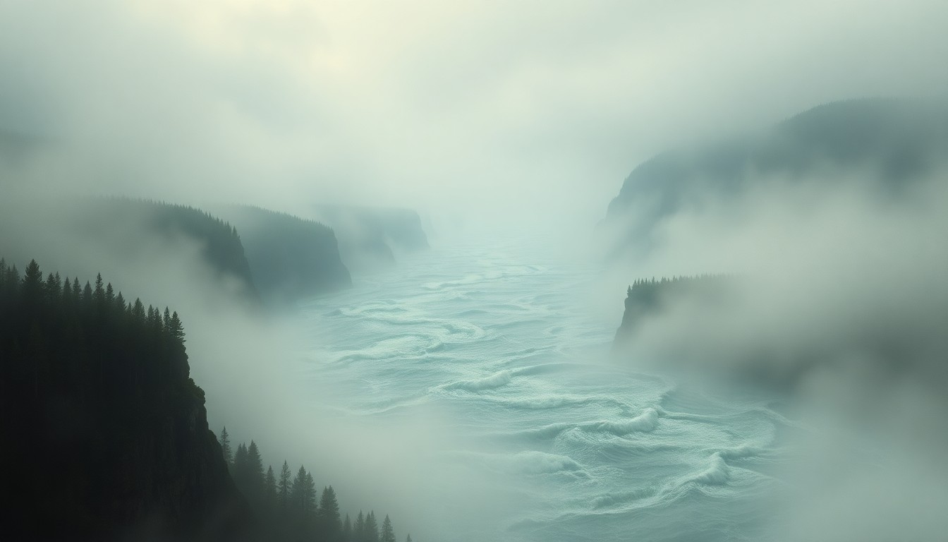 Resident-submitted photos and videos help the city map the devastating scope of a recent flood, underscoring the raw, sublime force of nature.Pullman Today
The City of Pullman, Washington is asking residents to submit photos and videos from the March 14 flooding event to help the city's GIS department build a more comprehensive map of how the flood unfolded across the city. Heavy rain that day caused the South Fork of the Palouse River to overflow its banks in two locations, leading to localized flooding downtown and several road closures.
Why it matters
Resident-submitted photos and videos can provide valuable data points to help the city's GIS team accurately document the extent and timeline of the March 14 flood. This information can inform future flood mitigation efforts and emergency response planning.
The details
The GIS team has been analyzing existing photos and videos, identifying landmarks, and using elevation contours and timestamps to map where the floodwaters went and when. An interactive Flood Extent Web Map has been created to display the results. Residents who took photos or video during the flood, particularly along the Bill Chipman Trail or other stream corridors, are encouraged to submit them through the city's website along with location and time details.
- The flooding occurred on March 14.
- Residents are asked to submit photos and videos from the March 14 flooding event.
The players
City of Pullman
The local government of Pullman, Washington, which is requesting resident-submitted photos and videos to help map the March 14 flooding event.
Pullman GIS Department
The city's geographic information systems (GIS) team that is analyzing submitted photos and videos to create an interactive flood map.
What’s next
The city will continue to collect and analyze resident-submitted photos and videos to refine the interactive Flood Extent Web Map.
The takeaway
By crowdsourcing flood documentation from residents, the City of Pullman can build a more comprehensive understanding of the March 14 flooding event to inform future emergency planning and mitigation efforts.