- Today
- Holidays
- Birthdays
- Reminders
- Cities
- Atlanta
- Austin
- Baltimore
- Berwyn
- Beverly Hills
- Birmingham
- Boston
- Brooklyn
- Buffalo
- Charlotte
- Chicago
- Cincinnati
- Cleveland
- Columbus
- Dallas
- Denver
- Detroit
- Fort Worth
- Houston
- Indianapolis
- Knoxville
- Las Vegas
- Los Angeles
- Louisville
- Madison
- Memphis
- Miami
- Milwaukee
- Minneapolis
- Nashville
- New Orleans
- New York
- Omaha
- Orlando
- Philadelphia
- Phoenix
- Pittsburgh
- Portland
- Raleigh
- Richmond
- Rutherford
- Sacramento
- Salt Lake City
- San Antonio
- San Diego
- San Francisco
- San Jose
- Seattle
- Tampa
- Tucson
- Washington
Heavy Rain, Gusty Winds Forecast for Burlington, Vermont
Wet roads, reduced visibility, and potential for isolated icy patches expected through the evening.
Apr. 10, 2026 at 7:54am
Got story updates? Submit your updates here. ›
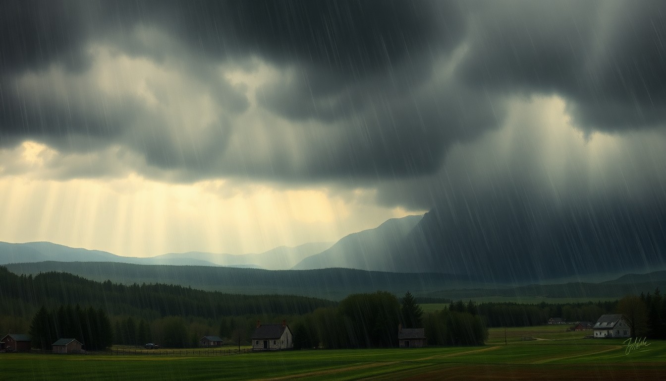 A powerful storm system brings heavy rain, gusty winds, and hazardous travel conditions to the Vermont countryside.Burlington Today
The National Weather Service has issued a weather alert for Burlington, Vermont, warning of an 80% chance of heavy rain, gusty winds up to 30 mph, and deteriorating travel conditions through the afternoon and evening. Drivers should prepare for wet pavement, sudden visibility drops, and the potential for isolated icy spots, especially on elevated surfaces.
Why it matters
This storm system could create hazardous driving conditions across the Burlington area, impacting both commuters and weekend travelers. The combination of heavy rain, strong winds, and the possibility of icy patches raises safety concerns and the need for residents to plan ahead and exercise caution on the roads.
The details
According to the National Weather Service, showers will increase in coverage throughout the day, with rain chances rising to 80% later this evening. South winds gusting up to 30 mph will create choppy conditions along Lake Champlain and push rain bands inland, reducing visibility. As temperatures drop into the mid-30s, colder pockets could allow brief slick spots to form, especially on elevated surfaces.
- Showers increase in coverage today with a 60% chance of rain and highs near 60°F.
- Rain intensifies later, with chances rising to 80% as temperatures fall into the mid-30s.
- Saturday offers a short break, with highs near 47°F and partial sunshine, but colder air could allow leftover moisture to refreeze, creating early-morning hazards.
- Sunday brings a 30% chance of showers and highs near 52°F, with additional rain developing Sunday night.
- Monday brings a stronger system, with a 70% chance of rain and highs near 64°F, impacting both morning and afternoon travel.
The players
National Weather Service
The federal agency responsible for weather forecasting and issuing weather alerts and warnings for the United States.
What they’re saying
“Drivers should prepare for wet pavement and sudden visibility drops as showers become more widespread. Gusty winds may also impact high-profile vehicles, especially on exposed roadways and bridges.”
— National Weather Service
What’s next
Residents in the Burlington area should monitor the weather forecast and road conditions closely, and plan for potential travel delays and hazardous driving conditions throughout the evening and into the weekend.
The takeaway
This storm system serves as a reminder for Vermont residents to stay vigilant and prepared for rapidly changing weather conditions, especially during the transition to spring. Drivers should exercise caution, allow extra time for travel, and be aware of the potential for slick spots and reduced visibility on the roads.
Burlington top stories


Burlington events

Apr. 19, 2026
Nick Offerman
Apr. 19, 2026
Nick Offerman