- Today
- Holidays
- Birthdays
- Reminders
- Cities
- Atlanta
- Austin
- Baltimore
- Berwyn
- Beverly Hills
- Birmingham
- Boston
- Brooklyn
- Buffalo
- Charlotte
- Chicago
- Cincinnati
- Cleveland
- Columbus
- Dallas
- Denver
- Detroit
- Fort Worth
- Houston
- Indianapolis
- Knoxville
- Las Vegas
- Los Angeles
- Louisville
- Madison
- Memphis
- Miami
- Milwaukee
- Minneapolis
- Nashville
- New Orleans
- New York
- Omaha
- Orlando
- Philadelphia
- Phoenix
- Pittsburgh
- Portland
- Raleigh
- Richmond
- Rutherford
- Sacramento
- Salt Lake City
- San Antonio
- San Diego
- San Francisco
- San Jose
- Seattle
- Tampa
- Tucson
- Washington
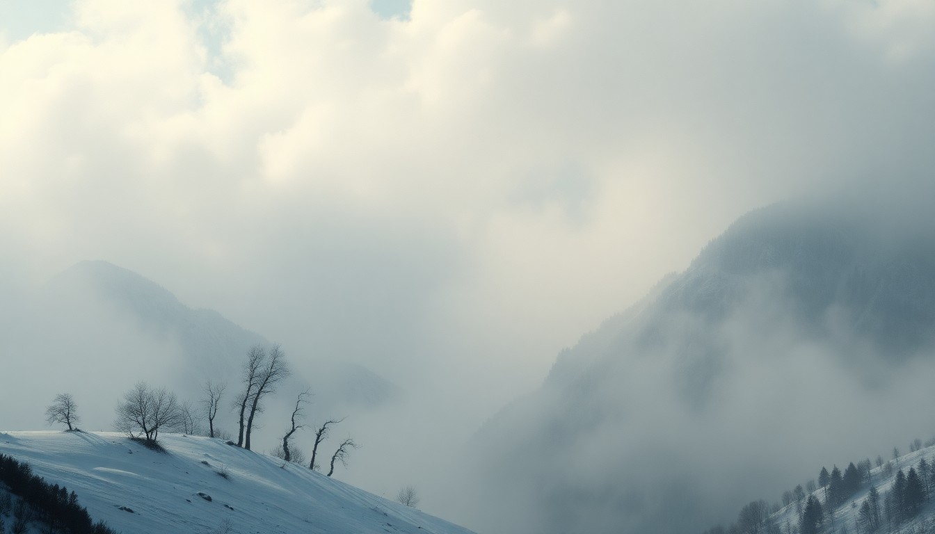
Wasatch Mountains Brace for Snowstorm as Warm Spell Ends
Quick-moving cold front to bring 5-10 inches of snow Monday evening, with another storm possible later this week
Mar. 2, 2026 at 2:31pm
Got story updates? Submit your updates here. ›
After an unseasonably warm start to March, a cold front is set to move into Utah on Monday, bringing heavy snow to the Wasatch Mountains. Forecasters expect 6-11 inches of snow in the Cottonwood Canyons, 3-7 inches in the Park City area, and 4-9 inches further north around Powder Mountain and Snowbasin. The snow is expected to arrive Monday evening and continue into early Tuesday morning. Another storm system could bring around a foot of additional snow later this week.
Why it matters
The Wasatch Mountains are a major draw for skiers and snowboarders, and significant snowfall is crucial for the region's winter tourism industry. After a below-average snowfall month in February, this storm could help replenish the snowpack ahead of the spring melt.
The details
The cold front moving in on Monday is expected to drop heavy, wet snow, with the potential for some thunder and graupel as well. Winds will shift to the northwest, which could lead to additional accumulations in the Cottonwood Canyons on Tuesday morning. The next storm system is forecast to arrive overnight Wednesday into Thursday, potentially bringing around a foot of new snow.
- The cold front is expected to move into Utah on Monday afternoon.
- The majority of the snowfall is expected Monday evening into early Tuesday morning.
- Lingering snow showers are possible in the Cottonwood Canyons on Tuesday morning.
- The next storm system is forecast to arrive overnight Wednesday into Thursday.
The players
National Weather Service
The federal agency responsible for weather forecasting and issuing weather-related warnings.
University of Utah Department of Atmospheric Sciences
The university's department that conducts research and provides expertise on weather and climate.
What they’re saying
“This winter has been the warmest on record, referring to 'meteorological winter,' which runs from December through March, with an average temperature of 40.7 °F at the Salt Lake City International Airport official weather observing station.”
— National Weather Service
What’s next
The National Weather Service will continue to monitor the storm systems and provide updated forecasts as the weather patterns evolve.
The takeaway
After an unusually warm start to March, the Wasatch Mountains are set to receive significant snowfall this week, which could help replenish the snowpack and support the region's vital winter tourism industry.