- Today
- Holidays
- Birthdays
- Reminders
- Cities
- Atlanta
- Austin
- Baltimore
- Berwyn
- Beverly Hills
- Birmingham
- Boston
- Brooklyn
- Buffalo
- Charlotte
- Chicago
- Cincinnati
- Cleveland
- Columbus
- Dallas
- Denver
- Detroit
- Fort Worth
- Houston
- Indianapolis
- Knoxville
- Las Vegas
- Los Angeles
- Louisville
- Madison
- Memphis
- Miami
- Milwaukee
- Minneapolis
- Nashville
- New Orleans
- New York
- Omaha
- Orlando
- Philadelphia
- Phoenix
- Pittsburgh
- Portland
- Raleigh
- Richmond
- Rutherford
- Sacramento
- Salt Lake City
- San Antonio
- San Diego
- San Francisco
- San Jose
- Seattle
- Tampa
- Tucson
- Washington
Green River Today
By the People, for the People
Geologists Unravel Mystery of Green River's Unlikely Path Through Uinta Mountains
New study proposes a deep, hidden process known as 'lithospheric drip' may explain how the river carved its unusual route.
Apr. 10, 2026 at 8:58pm
Got story updates? Submit your updates here. ›
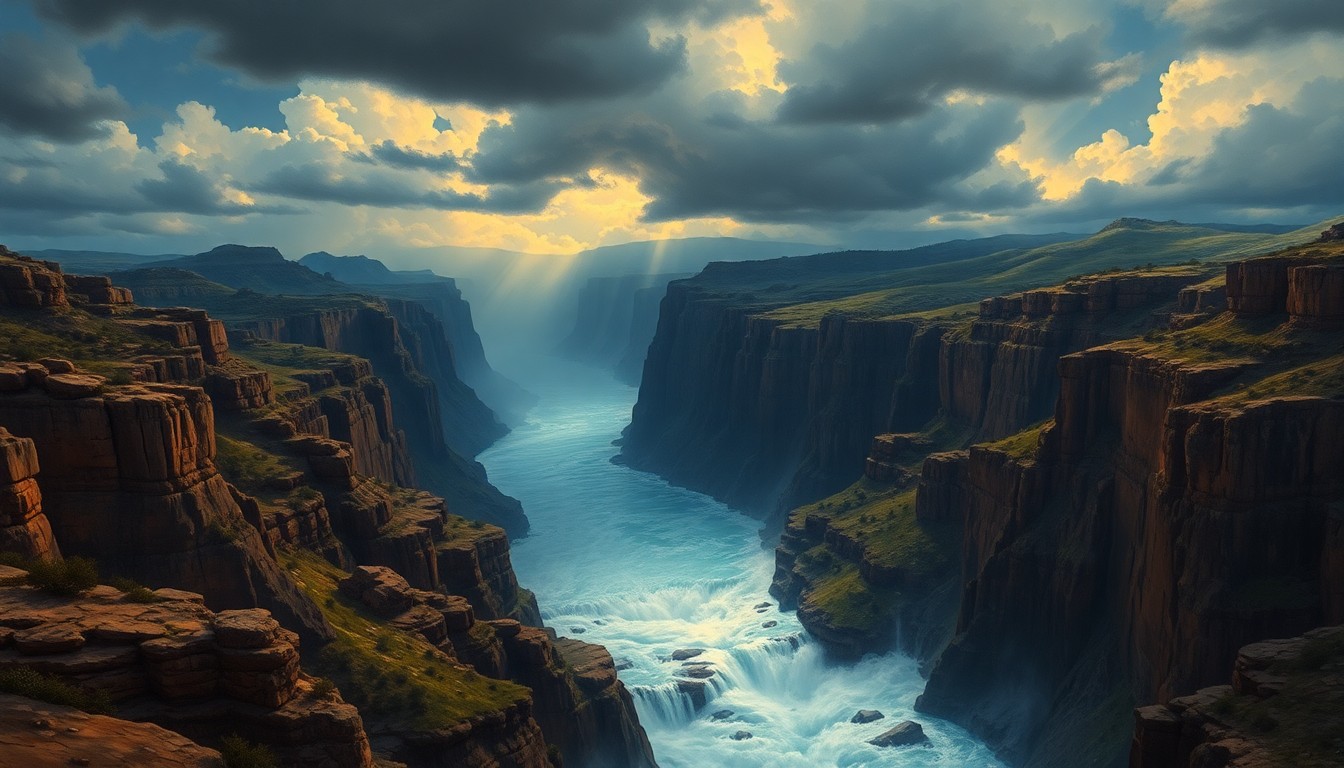
 A conceptual illustration depicting the hidden geological forces that have carved the Green River's unlikely path through the Uinta Mountains.Green River Today
For over a century, geologists have puzzled over how the Green River in northeastern Utah manages to slice through the hard limestone and sandstone of the Uinta Mountains, instead of following a path of least resistance around the range. A new study suggests the answer lies deep underground, where a process called 'lithospheric drip' may have temporarily lowered the mountains, allowing the river to establish its current course.
Why it matters
Understanding how the Green River defies expectations by cutting through the Uinta Mountains provides valuable insights into the complex interplay between rivers, geology, and tectonic forces that shape landscapes over millions of years. This research could also shed light on similar geological anomalies in other mountain ranges around the world.
The details
The Uinta Mountains are about 50 million years old, yet evidence shows the Green River has flowed along its current path for less than 8 million years, possibly as recently as 2 million years ago. This timing gap has long puzzled geologists. One hypothesis suggests the Yampa River to the south carved a channel through the mountains that the Green River later adopted, but this would have required immense erosive power. Another theory proposed that sediment buildup temporarily raised the Green River, allowing it to overtop the mountains, but the sediments aren't tall enough to account for the river's deep canyons.
- In June 1869, American geologist John Wesley Powell first attempted to explain the Green River's anomalous path.
- The Uinta Mountains formed roughly 50 million years ago.
- Researchers estimate the Green River began flowing along its present course between 2 million and 8 million years ago.
The players
John Wesley Powell
An American geologist who in 1869 proposed that the Green River predated the Uinta Mountains and carved its own channel as the land rose around it.
Adam Smith
A numerical modeling researcher at the University of Glasgow who has studied the Green River's unusual path through the Uinta Mountains.
Mitchell McMillan
A research geologist at the Georgia Institute of Technology who finds the 'lithospheric drip' hypothesis a credible explanation for the river's route.
What they’re saying
“It's such a weird path.”
— Adam Smith, Numerical modeling researcher
“They can happen wherever you have had a mountain range form, and they can happen at any time.”
— Adam Smith, Numerical modeling researcher
“The most exciting aspect is its use of surface clues to infer mantle processes and their impact on mountain belts, calling it a valuable demonstration of such an approach, regardless of whether the drip hypothesis is ultimately proven.”
— Mitchell McMillan, Research geologist
What’s next
Researchers plan to continue analyzing seismic data and modeling the geology of the Uinta Mountains to further test and refine the 'lithospheric drip' hypothesis.
The takeaway
The Green River's unlikely path through the Uinta Mountains highlights how even the most fundamental features of a landscape can be shaped by complex, hidden processes deep within the Earth's interior. This research demonstrates the value of integrating surface observations with advanced geophysical techniques to unravel long-standing geological mysteries.