- Today
- Holidays
- Birthdays
- Reminders
- Cities
- Atlanta
- Austin
- Baltimore
- Berwyn
- Beverly Hills
- Birmingham
- Boston
- Brooklyn
- Buffalo
- Charlotte
- Chicago
- Cincinnati
- Cleveland
- Columbus
- Dallas
- Denver
- Detroit
- Fort Worth
- Houston
- Indianapolis
- Knoxville
- Las Vegas
- Los Angeles
- Louisville
- Madison
- Memphis
- Miami
- Milwaukee
- Minneapolis
- Nashville
- New Orleans
- New York
- Omaha
- Orlando
- Philadelphia
- Phoenix
- Pittsburgh
- Portland
- Raleigh
- Richmond
- Rutherford
- Sacramento
- Salt Lake City
- San Antonio
- San Diego
- San Francisco
- San Jose
- Seattle
- Tampa
- Tucson
- Washington
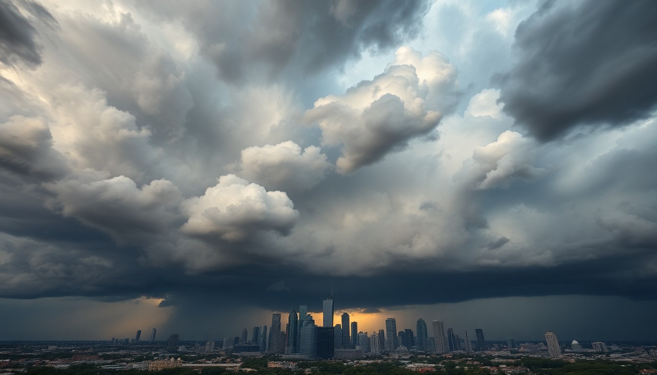
Isolated Storm Chances Across Houston Area
Warmer weather pattern with 80s returning this week
Apr. 12, 2026 at 3:03pm
Got story updates? Submit your updates here. ›
A few showers and storms will be possible through the day in the Houston area, but coverage will be limited. The highest likelihood for stronger storms will be west and northwest of the city, closer to College Station. Areas closer to the coast may stay mostly dry, with warm and humid conditions. Highs are expected to climb into the mid to upper 80s this week as the rain chances decrease.
Why it matters
Houston's weather can have a significant impact on the daily lives of residents, from commutes to outdoor activities. Knowing when and where storms may develop is crucial for people to plan accordingly and stay safe.
The details
The setup for storms on this day is very uncertain, but any storm that does develop could become strong quickly. The main concerns are isolated hail and gusty winds, with a very low tornado risk. The best chances for these stronger storms will be west and northwest of Houston, closer to the College Station area. Locations closer to the coast may stay mostly dry, though the overall conditions will be warm and humid.
- Storms will become more likely after about 2pm on Sunday, April 12, 2026.
- Highs are expected to climb into the mid to upper 80s through the new week.
The players
Fox Local
The local Fox television news station covering the Houston area.
Mike Iscovitz
A weather forecaster for Fox Local in Houston.
What they’re saying
“This is not a washout, but keep an eye on Fox Local through the evening as severe storms will become more likely after about 2pm.”
— Mike Iscovitz, Weather Forecaster
The takeaway
While the storm chances are isolated, it's important for Houston residents to stay vigilant and monitor the weather throughout the day, as any storms that do develop could become strong quickly. The warmer weather pattern settling in for the week ahead will also impact daily activities and plans.
Houston top stories


Houston events

Apr. 12, 2026
Houston Rockets vs. Memphis Grizzlies
Apr. 12, 2026
SIX (Touring)
Apr. 12, 2026
SIX (Touring)