- Today
- Holidays
- Birthdays
- Reminders
- Cities
- Atlanta
- Austin
- Baltimore
- Berwyn
- Beverly Hills
- Birmingham
- Boston
- Brooklyn
- Buffalo
- Charlotte
- Chicago
- Cincinnati
- Cleveland
- Columbus
- Dallas
- Denver
- Detroit
- Fort Worth
- Houston
- Indianapolis
- Knoxville
- Las Vegas
- Los Angeles
- Louisville
- Madison
- Memphis
- Miami
- Milwaukee
- Minneapolis
- Nashville
- New Orleans
- New York
- Omaha
- Orlando
- Philadelphia
- Phoenix
- Pittsburgh
- Portland
- Raleigh
- Richmond
- Rutherford
- Sacramento
- Salt Lake City
- San Antonio
- San Diego
- San Francisco
- San Jose
- Seattle
- Tampa
- Tucson
- Washington
Rainy Weather Ahead, But Not Excessive Precipitation
Forecasts show varied rainfall amounts across the region over the next 10 days
Apr. 10, 2026 at 6:20pm
Got story updates? Submit your updates here. ›
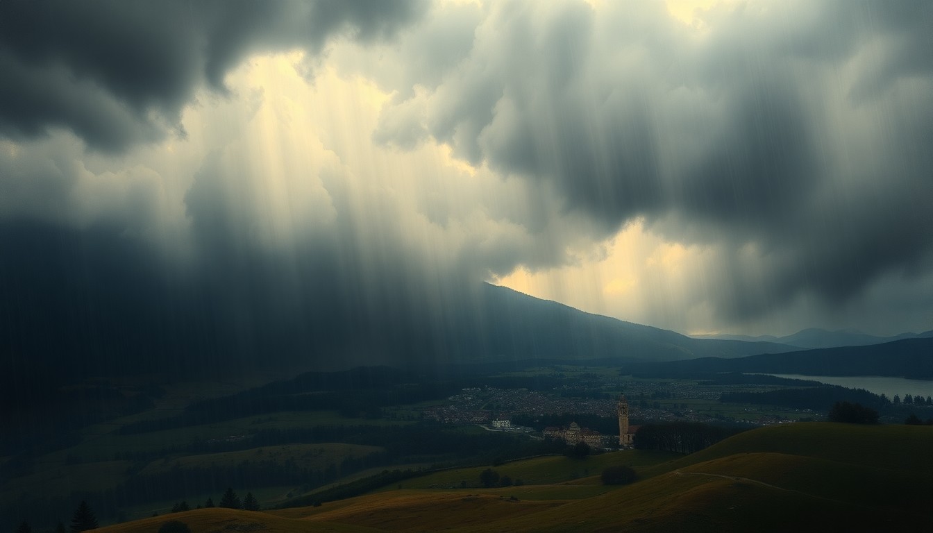 Dramatic weather patterns dwarf a small rural town, highlighting the power and unpredictability of the region's precipitation.Valley City Today
The region is about to enter a stormier period with numerous chances for showers, though precipitation levels are expected to remain manageable. While northern Minnesota is experiencing drier conditions, forecasts show a wide range of potential rainfall totals for the Fargo-Moorhead area, from 0.25 inches up to over 1 inch over the next 10 days. The heavier rain is predicted to fall to the east in Minnesota and the Great Lakes, and a ridge is expected to build in bringing warmer weather by the end of the month.
Why it matters
Consistent and adequate rainfall is crucial for the region's agriculture and water resources. While the upcoming weather pattern will bring more precipitation, the varied forecasts suggest a 'hit-or-miss' nature to the showers, which can make planning and preparation challenging.
The details
Computer models are showing a wide range of potential rainfall totals for the Fargo-Moorhead area over the next 10 days, from as little as 0.25 inches up to over 1 inch. This 'hit-and-miss' nature of the showers and storms is common, with the heavier precipitation expected to fall to the east in Minnesota and the Great Lakes region. A ridge is forecast to build in towards the end of the month, bringing warmer weather to the area.
- The region is about to enter a 'stormier' part of the LRC (Lezak Recurring Cycle) over the next 10 days, with numerous chances for showers.
- There is potential for a stronger storm around April 22nd that could bring either rain or snow to the area.
The players
Weather2020
A weather forecasting service that previously reported that all of North Dakota is doing well in regards to precipitation levels.
The takeaway
While the upcoming weather pattern will bring more precipitation to the region, the varied forecasts suggest a 'hit-or-miss' nature to the showers, which can make planning and preparation challenging. Consistent and adequate rainfall is crucial for the region's agriculture and water resources.