- Today
- Holidays
- Birthdays
- Reminders
- Cities
- Atlanta
- Austin
- Baltimore
- Berwyn
- Beverly Hills
- Birmingham
- Boston
- Brooklyn
- Buffalo
- Charlotte
- Chicago
- Cincinnati
- Cleveland
- Columbus
- Dallas
- Denver
- Detroit
- Fort Worth
- Houston
- Indianapolis
- Knoxville
- Las Vegas
- Los Angeles
- Louisville
- Madison
- Memphis
- Miami
- Milwaukee
- Minneapolis
- Nashville
- New Orleans
- New York
- Omaha
- Orlando
- Philadelphia
- Phoenix
- Pittsburgh
- Portland
- Raleigh
- Richmond
- Rutherford
- Sacramento
- Salt Lake City
- San Antonio
- San Diego
- San Francisco
- San Jose
- Seattle
- Tampa
- Tucson
- Washington
Round 2 of Spring Storm Promises Heavier Snow in North Dakota
After a brief break, a second system is expected to bring over 10 inches of snow to the Fargo-Moorhead area this weekend.
Apr. 2, 2026 at 10:58pm
Got story updates? Submit your updates here. ›
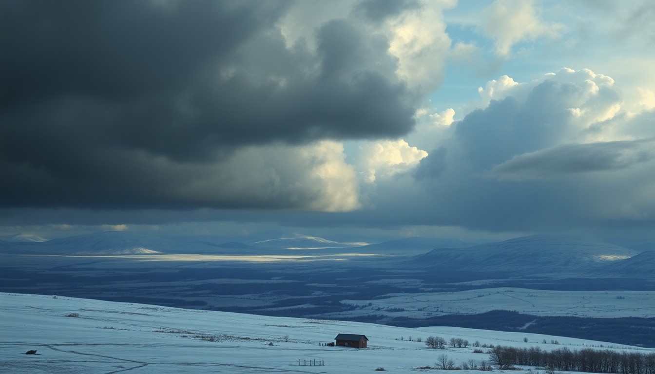 A powerful spring snowstorm sweeps across the northern Plains, underscoring the region's harsh yet awe-inspiring natural beauty.Fargo Today
A spring snowstorm is impacting the northern Plains, with the first round bringing 2-4 inches of snow to the central and southern parts of the region. After a brief break, a second, more powerful storm system is expected to move in on Friday night into Saturday, potentially dumping over 10 inches of snow in the Fargo-Moorhead area and surrounding regions of North Dakota.
Why it matters
Spring snowstorms can cause significant disruptions to daily life, impacting travel, power, and other critical infrastructure. This storm system is expected to be particularly impactful, with heavy snowfall and the potential for dangerous winter driving conditions.
The details
The first round of snow is expected to wind down later this afternoon, with the northern parts of the Valley and northwest Minnesota continuing to see snowfall. A break in the snow is expected tonight through Friday midday, before the second, more powerful storm system moves in. This second storm is forecast to bring heavy snow, with the Fargo-Moorhead area potentially seeing over 10 inches of accumulation. The worst of the storm is expected to hit Friday night into Saturday morning.
- The first round of snow is expected to end later this afternoon.
- There will be a break in the snow from tonight through Friday midday.
- The second, more powerful storm system is expected to move in on Friday night.
- The heaviest snow from the second storm is expected Friday night into Saturday morning.
The players
National Weather Service
The federal agency responsible for issuing weather forecasts and warnings for the United States.
What’s next
Residents in the affected areas should monitor the latest weather forecasts and be prepared for potentially dangerous winter driving conditions this weekend.
The takeaway
This spring snowstorm is a reminder of the unpredictable nature of the weather, and the importance of being prepared for sudden changes in conditions, especially in northern regions where heavy snowfall can have significant impacts on daily life.