- Today
- Holidays
- Birthdays
- Reminders
- Cities
- Atlanta
- Austin
- Baltimore
- Berwyn
- Beverly Hills
- Birmingham
- Boston
- Brooklyn
- Buffalo
- Charlotte
- Chicago
- Cincinnati
- Cleveland
- Columbus
- Dallas
- Denver
- Detroit
- Fort Worth
- Houston
- Indianapolis
- Knoxville
- Las Vegas
- Los Angeles
- Louisville
- Madison
- Memphis
- Miami
- Milwaukee
- Minneapolis
- Nashville
- New Orleans
- New York
- Omaha
- Orlando
- Philadelphia
- Phoenix
- Pittsburgh
- Portland
- Raleigh
- Richmond
- Rutherford
- Sacramento
- Salt Lake City
- San Antonio
- San Diego
- San Francisco
- San Jose
- Seattle
- Tampa
- Tucson
- Washington
Glasgow Today
By the People, for the People
Montana Braces for Sudden Cold Snap and Snow
Temperatures to plummet 40°F with rain turning to snow by Wednesday night
Mar. 28, 2026 at 10:03am
Got story updates? Submit your updates here. ›
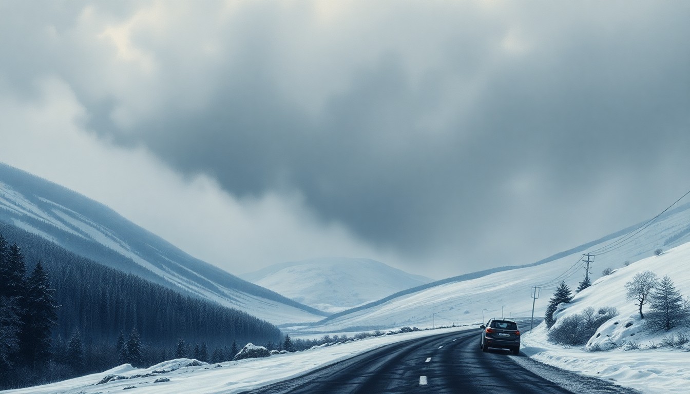 A sudden winter storm sweeps across the vast, frozen landscapes of northeast Montana, posing hazards for travelers on the region's remote highways.Glasgow Today
A sharp cooldown is expected to hit northeast Montana this week, with temperatures dropping from highs around 60°F on Monday to the 30s and 40s by Tuesday. Rain showers on Monday will transition to a mix of rain and snow by Wednesday night, creating hazardous travel conditions across the region.
Why it matters
Sudden changes in weather can pose significant risks for drivers and outdoor activities in rural Montana, where long stretches of highway and county roads may become treacherous. The transition from mild, dry weather to a colder, wetter pattern could impact travel, school schedules, and other daily routines across communities along the Hi-Line.
The details
According to the National Weather Service in Glasgow, dry and seasonable conditions will hold through the weekend, with highs ranging from the low 50s to upper 60s. However, a cold front moving in on Sunday night will bring increasing chances for showers across the region into Monday. By Tuesday, colder air will push in, dropping highs into the 30s and low 40s, especially along the Hi-Line and U.S. Highway 2. The most significant change arrives by Wednesday night into Friday, when additional moisture combines with the colder temperatures to bring a mix of rain and snow, potentially creating slick travel conditions.
- Dry, seasonable conditions through the weekend (March 25-26)
- Cold front moves in Sunday night (March 26)
- Rain showers develop on Monday (March 27)
- Temperatures drop into the 30s and 40s on Tuesday (March 28)
- Rain and snow mix expected Wednesday night through Friday (March 29 - March 31)
The players
National Weather Service in Glasgow
The local office of the National Weather Service that provides weather forecasts and warnings for northeast Montana.
What’s next
Residents should prepare for rapidly changing conditions, including wet roads transitioning to icy patches later in the week. Additional weather advisories are likely as precipitation type and timing become clearer.
The takeaway
Sudden shifts in weather patterns can have significant impacts on travel and daily routines in rural Montana communities. Residents should stay vigilant and prepared for potential hazardous conditions as temperatures drop and precipitation changes from rain to snow later this week.