- Today
- Holidays
- Birthdays
- Reminders
- Cities
- Atlanta
- Austin
- Baltimore
- Berwyn
- Beverly Hills
- Birmingham
- Boston
- Brooklyn
- Buffalo
- Charlotte
- Chicago
- Cincinnati
- Cleveland
- Columbus
- Dallas
- Denver
- Detroit
- Fort Worth
- Houston
- Indianapolis
- Knoxville
- Las Vegas
- Los Angeles
- Louisville
- Madison
- Memphis
- Miami
- Milwaukee
- Minneapolis
- Nashville
- New Orleans
- New York
- Omaha
- Orlando
- Philadelphia
- Phoenix
- Pittsburgh
- Portland
- Raleigh
- Richmond
- Rutherford
- Sacramento
- Salt Lake City
- San Antonio
- San Diego
- San Francisco
- San Jose
- Seattle
- Tampa
- Tucson
- Washington
Central Illinois Braces for Stormy Weather This Weekend
70% storm chances expected by Friday, with showers starting after midnight tonight
Apr. 8, 2026 at 8:34am
Got story updates? Submit your updates here. ›
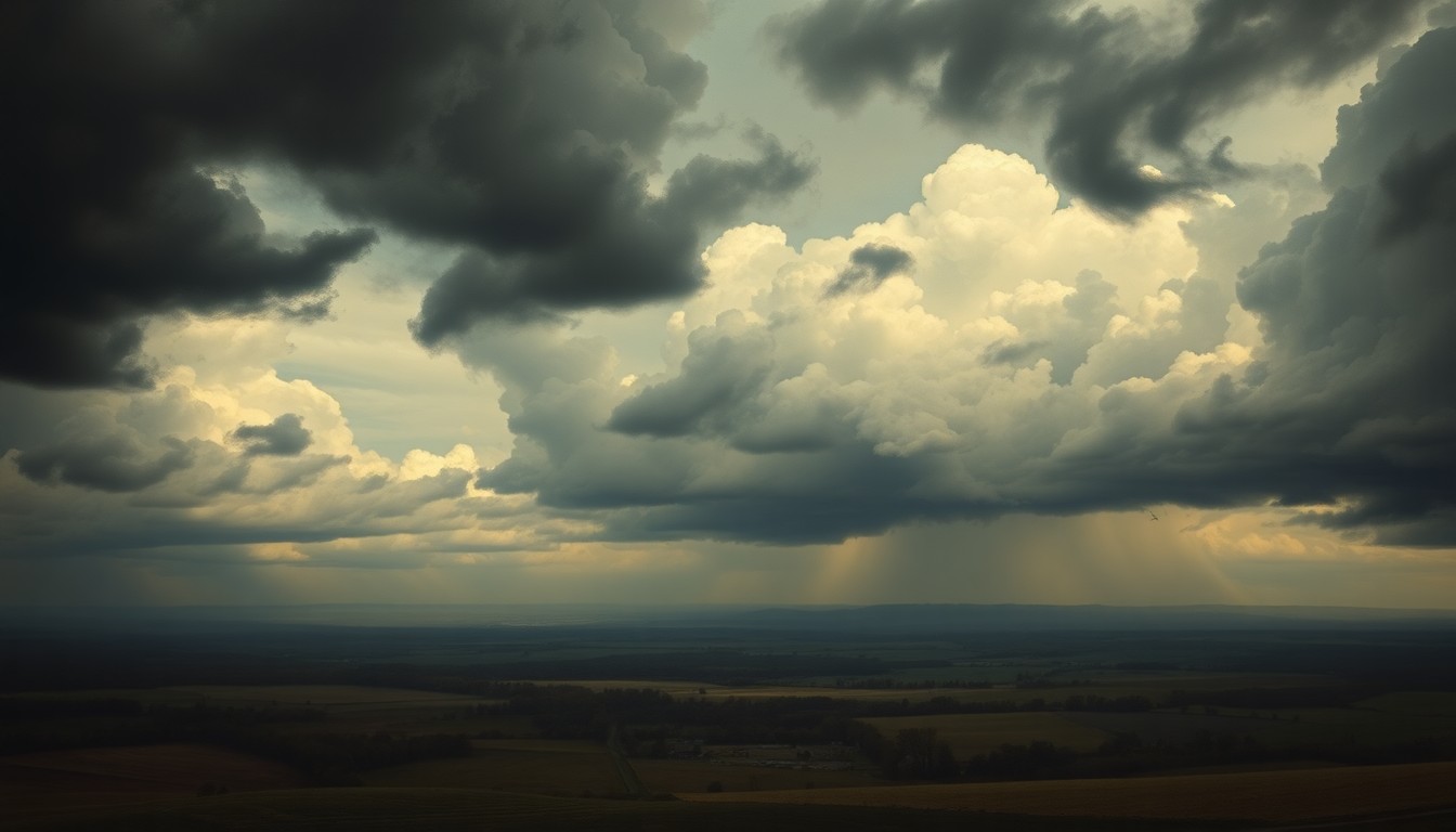 A looming storm system threatens to bring heavy rain, potential flooding, and travel disruptions to central Illinois this weekend.Springfield Today
Showers and thunderstorms are set to return to central Illinois within hours, with the first round developing after midnight and continuing in waves through the weekend. Storm chances begin increasing late tonight, especially along and north of the I-72 corridor, with a 20 to 50 percent chance of showers and thunderstorms overnight. The most widespread rain arrives Friday, when storm chances peak between 50 and 70 percent across cities including Springfield, Peoria, Bloomington, and Champaign.
Why it matters
The incoming storm system could lead to localized flooding, reduced visibility, and travel disruptions across the region. While the risk for severe weather remains low, repeated rounds of rain may cause ponding on roads, especially in low-lying and urban areas. Residents should stay alert for changing conditions and any additional weather advisories.
The details
According to the National Weather Service in Lincoln, storm chances begin increasing late tonight, with a 20 to 50 percent chance of showers and thunderstorms overnight. Activity expands Thursday, with additional development north of I-70 and temperatures climbing into the 70 to 77 degree range. The most widespread rain arrives Friday, when storm chances peak between 50 and 70 percent across central Illinois cities.
- Showers and thunderstorms are expected to develop after midnight tonight.
- Storm chances increase late tonight, especially along and north of the I-72 corridor.
- Additional storm development is expected on Thursday, north of I-70.
- The most widespread rain arrives on Friday, with storm chances peaking between 50 and 70 percent.
- Scattered showers are expected on Saturday, with a renewed 30 to 40 percent chance of thunderstorms on Sunday, particularly west of I-55.
The players
National Weather Service in Lincoln
The regional office of the National Weather Service that issued the weather alert for central Illinois.
What’s next
Residents should stay alert for changing conditions, especially during overnight and early morning hours, as additional updates or advisories may be issued through Sunday.
The takeaway
The incoming storm system poses a risk of localized flooding, reduced visibility, and travel disruptions across central Illinois. Residents should monitor weather conditions and be prepared to adjust their plans if necessary.
Springfield top stories


Springfield events

Apr. 10, 2026
Springfield Jr. Blues vs. Wisconsin Windigo
Apr. 11, 2026
Jeff Dunham Artificial Intelligence
Apr. 11, 2026
Springfield Jr. Blues vs. Wisconsin Windigo