- Today
- Holidays
- Birthdays
- Reminders
- Cities
- Atlanta
- Austin
- Baltimore
- Berwyn
- Beverly Hills
- Birmingham
- Boston
- Brooklyn
- Buffalo
- Charlotte
- Chicago
- Cincinnati
- Cleveland
- Columbus
- Dallas
- Denver
- Detroit
- Fort Worth
- Houston
- Indianapolis
- Knoxville
- Las Vegas
- Los Angeles
- Louisville
- Madison
- Memphis
- Miami
- Milwaukee
- Minneapolis
- Nashville
- New Orleans
- New York
- Omaha
- Orlando
- Philadelphia
- Phoenix
- Pittsburgh
- Portland
- Raleigh
- Richmond
- Rutherford
- Sacramento
- Salt Lake City
- San Antonio
- San Diego
- San Francisco
- San Jose
- Seattle
- Tampa
- Tucson
- Washington
Powerful Winds and Storms Batter Chicago Area
Gusts up to 45 mph and heavy rain expected through Tuesday
Apr. 12, 2026 at 9:53am
Got story updates? Submit your updates here. ›
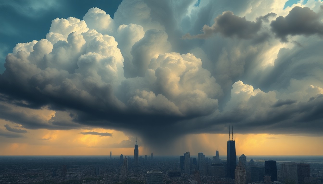 A looming storm system threatens to overwhelm the Chicago skyline, underscoring the region's vulnerability to severe weather.Chicago Today
A strong weather system is bringing powerful winds and scattered thunderstorms to the Chicago area today, with conditions expected to worsen into Tuesday. Gusts up to 45 mph are possible, along with heavy rain that could lead to localized flooding and slick roads, especially during the evening commute.
Why it matters
Severe weather can cause significant disruptions to daily life, from power outages and transportation issues to property damage. Residents in the Chicago area need to be prepared for the potential impacts of these storms.
The details
The National Weather Service in Chicago is forecasting a limited thunderstorm risk through tonight, with southwest winds reaching 40 to 45 mph by mid-afternoon. Storm coverage is expected to increase into the evening, with an 80% chance of rain and localized rainfall totals approaching a half inch. The stormy pattern is expected to continue into Tuesday, with a 60% chance of showers and thunderstorms in the afternoon climbing to 80% Tuesday night. Gusty winds and heavy rain could slow commutes on major highways like I-90 and Lake Shore Drive, and isolated flooding is possible in low-lying areas.
- This afternoon, wind gusts up to 45 mph are expected.
- Tonight, an 80% chance of rain with localized rainfall up to a half inch.
- Monday night, storms redevelop, especially north of I-80, with a growing chance for stronger cells.
- Tuesday afternoon, a 60% chance of showers and thunderstorms, increasing to 80% Tuesday night.
The players
National Weather Service in Chicago
The local office of the National Weather Service, the primary source of weather data and forecasts for the Chicago metropolitan area.
What they’re saying
“Expect shifting conditions through the day, especially along I-55 and I-94 where brief downpours could reduce visibility quickly.”
— National Weather Service in Chicago
What’s next
Residents should monitor the weather forecast and be prepared for potential power outages, travel disruptions, and flooding. The National Weather Service will continue to provide updates on the storm system as it moves through the area.
The takeaway
This powerful weather system serves as a reminder of the importance of being prepared for severe storms in the Chicago area. Residents should stay vigilant, heed weather warnings, and take necessary precautions to protect themselves and their property.