- Today
- Holidays
- Birthdays
- Reminders
- Cities
- Atlanta
- Austin
- Baltimore
- Berwyn
- Beverly Hills
- Birmingham
- Boston
- Brooklyn
- Buffalo
- Charlotte
- Chicago
- Cincinnati
- Cleveland
- Columbus
- Dallas
- Denver
- Detroit
- Fort Worth
- Houston
- Indianapolis
- Knoxville
- Las Vegas
- Los Angeles
- Louisville
- Madison
- Memphis
- Miami
- Milwaukee
- Minneapolis
- Nashville
- New Orleans
- New York
- Omaha
- Orlando
- Philadelphia
- Phoenix
- Pittsburgh
- Portland
- Raleigh
- Richmond
- Rutherford
- Sacramento
- Salt Lake City
- San Antonio
- San Diego
- San Francisco
- San Jose
- Seattle
- Tampa
- Tucson
- Washington
Hanford Today
By the People, for the People
Yosemite Area Braces for Dangerous Winter Storm
Visibility could drop below 1/4 mile by Friday night as heavy snow and high winds hit the Sierra Nevada
Apr. 9, 2026 at 9:19am
Got story updates? Submit your updates here. ›
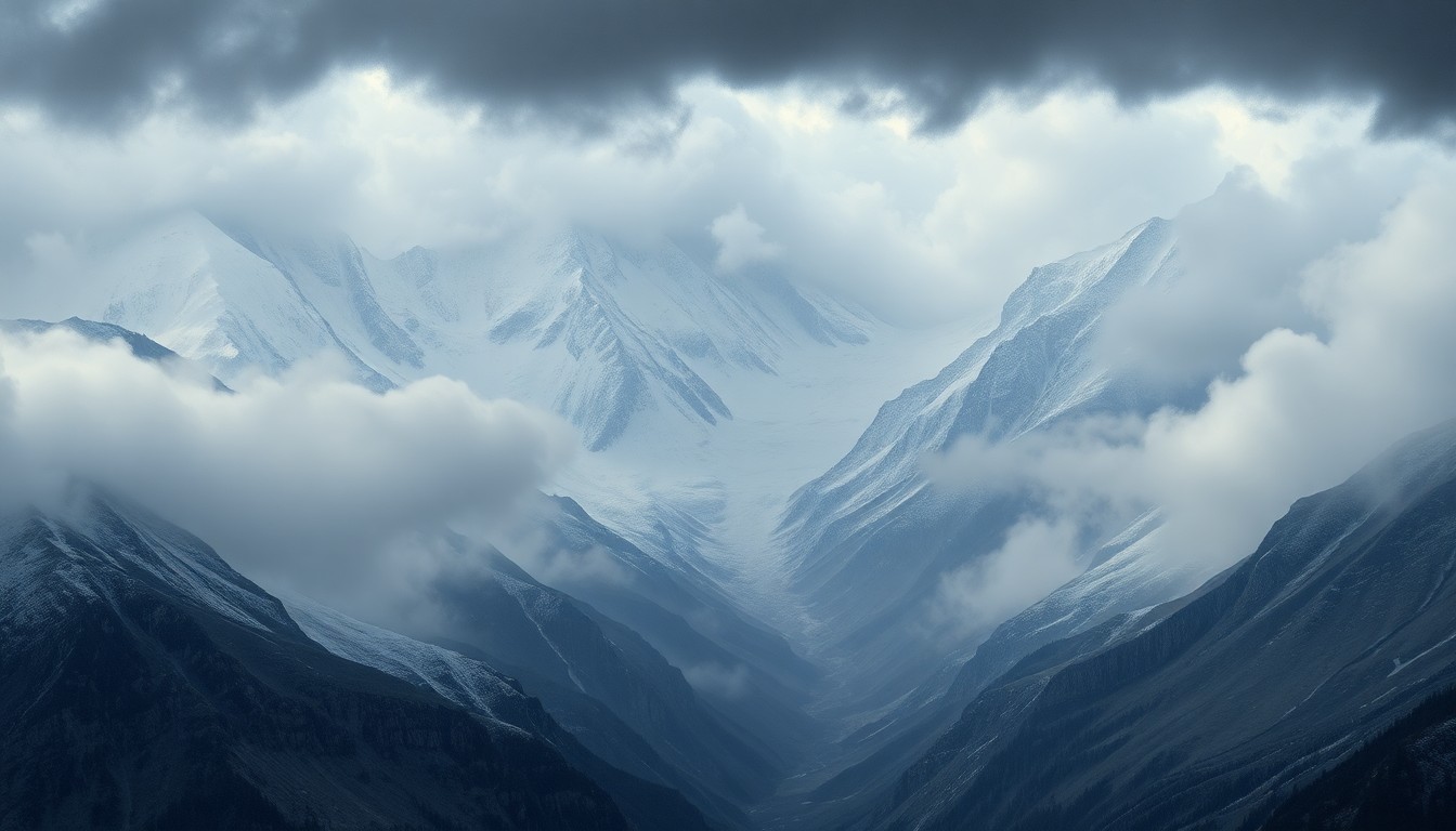 A looming winter storm envelops the Yosemite region, underscoring the raw, sublime power of nature in the Sierra Nevada.Hanford Today
A powerful winter storm is set to hit the Yosemite region starting Friday, with forecasters warning of life-threatening conditions due to heavy snow, high winds, and dangerously low visibility. Travel across the Sierra Nevada is expected to become extremely hazardous, with the potential for impassable roads, downed power lines, and scattered power outages.
Why it matters
The Yosemite area is a major tourist destination, especially in the winter months, so this storm poses a serious threat to both residents and visitors. Extreme weather events like this can have significant economic impacts on local communities that rely on tourism, as well as pose risks to public safety.
The details
According to the National Weather Service in Hanford, a Winter Storm Watch is in effect from Friday afternoon through Sunday evening for elevations above 7,000 feet, stretching from Yosemite National Park south to the Lake Isabella region. Forecasters warn visibility could drop below a quarter mile by Friday night, especially along exposed ridgelines and passes. Communities including Shaver Lake, Huntington Lake, Tuolumne Meadows, and Lodgepole are likely to see rapidly deteriorating conditions, with snow-covered bridges and steep grades along mountain routes becoming impassable at times. Strong winds may also snap tree limbs, increasing the risk of downed power lines and scattered outages.
- The storm's peak impacts are expected between late Friday night and Saturday afternoon.
- Hazardous conditions are expected to linger into Sunday evening.
The players
National Weather Service in Hanford
The local office of the National Weather Service that issued the Winter Storm Watch and forecast for the Yosemite region.
What’s next
Additional alerts or warnings may be issued as confidence in snowfall totals increases.
The takeaway
This powerful winter storm poses a serious threat to the Yosemite region, with the potential for hazardous travel conditions, power outages, and risks to public safety. Residents and visitors are urged to delay travel and take necessary precautions if driving is unavoidable.