- Today
- Holidays
- Birthdays
- Reminders
- Cities
- Atlanta
- Austin
- Baltimore
- Berwyn
- Beverly Hills
- Birmingham
- Boston
- Brooklyn
- Buffalo
- Charlotte
- Chicago
- Cincinnati
- Cleveland
- Columbus
- Dallas
- Denver
- Detroit
- Fort Worth
- Houston
- Indianapolis
- Knoxville
- Las Vegas
- Los Angeles
- Louisville
- Madison
- Memphis
- Miami
- Milwaukee
- Minneapolis
- Nashville
- New Orleans
- New York
- Omaha
- Orlando
- Philadelphia
- Phoenix
- Pittsburgh
- Portland
- Raleigh
- Richmond
- Rutherford
- Sacramento
- Salt Lake City
- San Antonio
- San Diego
- San Francisco
- San Jose
- Seattle
- Tampa
- Tucson
- Washington
Thunderstorms Forecast to Bring Heavy Rain Across California
Active weather system expected to impact multiple regions this week
Apr. 6, 2026 at 8:38pm
Got story updates? Submit your updates here. ›
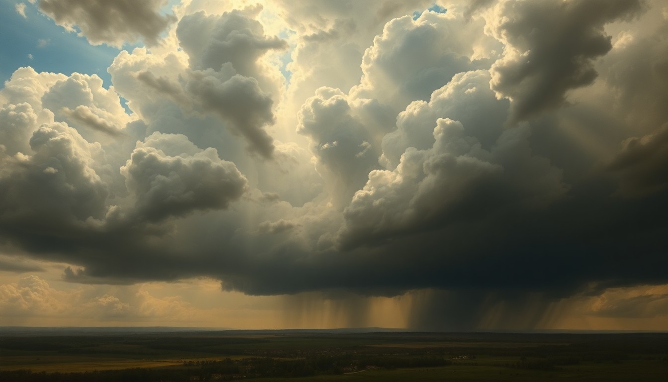 An impending storm system brings the promise of much-needed rainfall but also the threat of severe weather to California's diverse landscapes.Fresno Today
An active weather pattern is set to bring thunderstorms, heavy rain, and unsettled conditions to much of California starting on Thursday, April 9. The National Weather Service is forecasting a 20-35% chance of thunderstorms on Thursday and Friday, with the potential for over an inch of rainfall in some areas. Regions including the Central Valley, foothills, and Sierra Nevada mountains are expected to see the highest rainfall totals, while coastal and Southern California areas will likely see lighter precipitation.
Why it matters
The incoming storm system could provide much-needed rainfall to help alleviate drought conditions across the state, which saw a very hot and dry March that significantly reduced the Sierra Nevada snowpack. However, the heavy rain and thunderstorms also raise the risk of flash flooding, power outages, and other weather-related impacts, especially in areas that have already experienced wildfires or other natural disasters.
The details
According to the National Weather Service, the thunderstorms could start as early as Wednesday, April 8, and continue through Saturday, April 11. The highest chances for rain are forecast for Thursday and Friday, with a 20-35% chance of thunderstorms during that time. Some areas could see over an inch of rainfall, though forecasters say there is still uncertainty around the exact timing and rainfall totals. The storm system is expected to bring cooler temperatures, gusty winds, and the potential for small hail and lightning.
- Thunderstorms could begin as early as Wednesday, April 8.
- The highest chances for thunderstorms are forecast for Thursday, April 9, and Friday, April 10, with a 20-35% chance.
- Rain chances are expected to continue through the weekend.
The players
National Weather Service
The federal agency responsible for weather forecasting and issuing weather-related warnings and advisories.
What’s next
Residents in the affected regions should monitor the latest weather forecasts and be prepared for the possibility of heavy rain, thunderstorms, and potential flooding or other weather-related impacts. The National Weather Service will continue to provide updates on the timing and intensity of the storm system as it approaches.
The takeaway
This incoming storm system has the potential to provide much-needed rainfall to help alleviate drought conditions across California, but it also raises the risk of weather-related hazards like flash flooding, power outages, and small hail. Residents should stay informed and prepared as the storm system moves through the state later this week.
Fresno top stories


Fresno events

Apr. 7, 2026
Hadestown (Touring)

Apr. 8, 2026
Hadestown (Touring)