- Today
- Holidays
- Birthdays
- Reminders
- Cities
- Atlanta
- Austin
- Baltimore
- Berwyn
- Beverly Hills
- Birmingham
- Boston
- Brooklyn
- Buffalo
- Charlotte
- Chicago
- Cincinnati
- Cleveland
- Columbus
- Dallas
- Denver
- Detroit
- Fort Worth
- Houston
- Indianapolis
- Knoxville
- Las Vegas
- Los Angeles
- Louisville
- Madison
- Memphis
- Miami
- Milwaukee
- Minneapolis
- Nashville
- New Orleans
- New York
- Omaha
- Orlando
- Philadelphia
- Phoenix
- Pittsburgh
- Portland
- Raleigh
- Richmond
- Rutherford
- Sacramento
- Salt Lake City
- San Antonio
- San Diego
- San Francisco
- San Jose
- Seattle
- Tampa
- Tucson
- Washington
Globe Today
By the People, for the People
Delayed Flood Maps Leave Globe Rebuilding at Risk Before Monsoon Storms
Updated flood maps are delayed again as residents and leaders brace for monsoon storms this summer.
Mar. 27, 2026 at 2:05am
Got story updates? Submit your updates here. ›
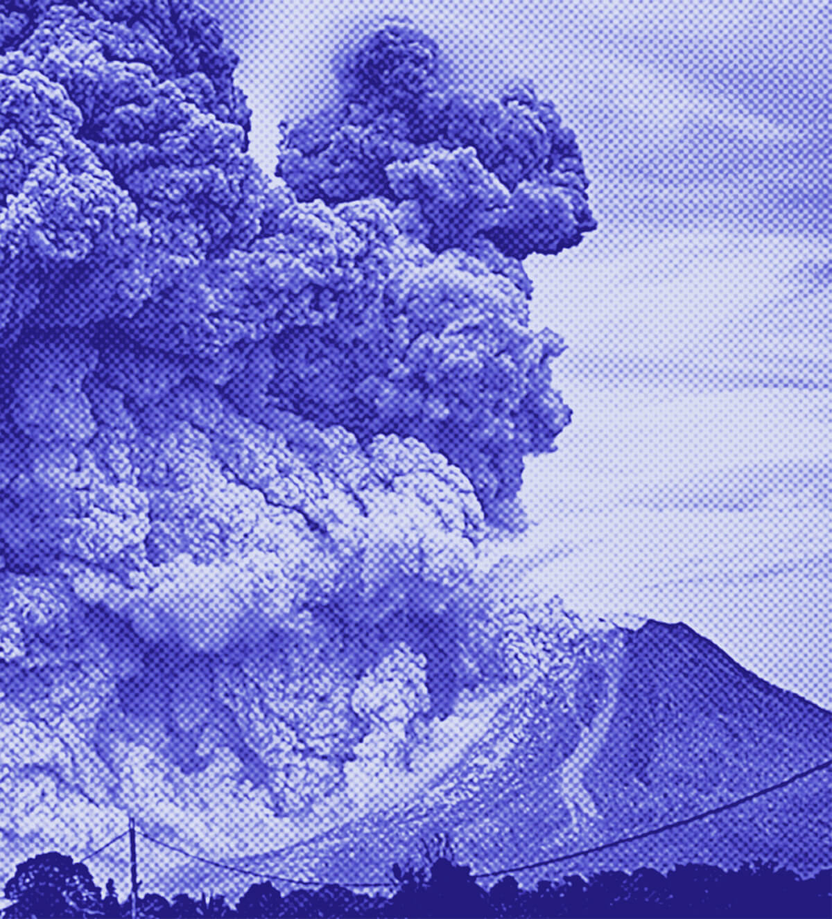
Six months after deadly flooding devastated Globe, Arizona, the city continues to rebuild using 30-year-old flood maps. Floodwaters turned downtown Globe into a river in September 2025, killing three people and causing a major hazardous materials emergency. Homeowners and business owners have been working to rebuild, but the delayed updated flood maps are complicating risk management efforts.
Why it matters
Accurate and up-to-date flood maps are crucial for determining where new development should go, how it should be built, and where to stage resources and deploy first responders during flooding events. Without the updated maps, Globe residents and leaders are left in the dark about the true flood risks as they rebuild from the previous disaster and brace for the upcoming monsoon season.
The details
The first draft of updated flood maps for Globe was supposed to be sent to city leaders last summer, but that was pushed to the end of 2025. The county now has the maps, but this is just the first step. FEMA says the delay is due to technical issues related to the high-resolution terrain data required for hydraulic modeling, with the new projected preliminary issuance date set for August 31, 2026. Many of the flooded areas continue to have a high risk of flooding, according to the county.
- In September 2025, floodwaters turned downtown Globe into a river, killing three people and causing a major hazardous materials emergency.
- Over the last six months, homeowners and business owners have been working to rebuild.
- The first draft of updated flood maps was originally supposed to be sent to city leaders last summer, but was pushed to the end of 2025.
- The county now has the updated maps, but this is just the first step.
- The new projected preliminary issuance date for the updated flood maps is August 31, 2026.
The players
David Berrey
A business owner who bought four buildings downtown in 2020 and has been working to rebuild after the flooding.
Al Gameros
The mayor of Globe, who said the flooding has been "an eye opener" for the community.
Paul Jepson
The Globe city manager, who said there has been a push to redo the outdated flood maps because they were last updated in 1987.
FEMA
The federal agency responsible for creating the flood maps, which has cited technical issues related to high-resolution terrain data as the reason for the delay in updating the maps.
What they’re saying
“Well, if the flood mapping is properly taken care of ahead of time, then people would have had better opportunities to get flood insurance and to know what it would actually cost.”
— David Berrey, Business owner
“This has really been an eye opener for our community.”
— Al Gameros, Mayor of Globe
“No one wants to see someone put a lot of money into a site that has a high chance of being washed down the creek at a storm event.”
— Paul Jepson, Globe city manager
What’s next
The county confirmed the new mapping is on track to take effect no sooner than one year from now, in August 2026.
The takeaway
The delayed flood map updates have left Globe residents and leaders in a precarious position as they work to rebuild from the previous disaster and prepare for the upcoming monsoon season. Without accurate and up-to-date flood risk information, the community's recovery efforts remain at risk, highlighting the critical importance of timely flood mapping for disaster preparedness and resilience.