- Today
- Holidays
- Birthdays
- Reminders
- Cities
- Atlanta
- Austin
- Baltimore
- Berwyn
- Beverly Hills
- Birmingham
- Boston
- Brooklyn
- Buffalo
- Charlotte
- Chicago
- Cincinnati
- Cleveland
- Columbus
- Dallas
- Denver
- Detroit
- Fort Worth
- Houston
- Indianapolis
- Knoxville
- Las Vegas
- Los Angeles
- Louisville
- Madison
- Memphis
- Miami
- Milwaukee
- Minneapolis
- Nashville
- New Orleans
- New York
- Omaha
- Orlando
- Philadelphia
- Phoenix
- Pittsburgh
- Portland
- Raleigh
- Richmond
- Rutherford
- Sacramento
- Salt Lake City
- San Antonio
- San Diego
- San Francisco
- San Jose
- Seattle
- Tampa
- Tucson
- Washington
Jasper Today
By the People, for the People
NWS Issues Special Statement For East Texas Wildfire Danger
Gusty winds and dry conditions raise fire risk in the Pineywoods region
Mar. 28, 2026 at 4:04pm
Got story updates? Submit your updates here. ›
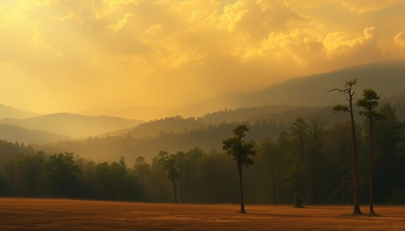 The looming threat of wildfire hangs over the East Texas Pineywoods as gusty winds and dry conditions create an elevated risk for the region.Jasper Today
The National Weather Service has released a statement concerning elevated wildfire danger in East Texas on Saturday due to gusty north winds, critically dry conditions, and low humidity. County-wide burn bans are in place for several counties, and outdoor burning is highly discouraged across the region despite recent scattered rainfall.
Why it matters
East Texas is in a moderate-to-severe drought, making the area particularly susceptible to the rapid spread of wildfires. The weather conditions on Saturday will create an elevated fire risk, potentially threatening homes, businesses, and natural habitats if any fires break out.
The details
The NWS statement covers extreme southeast Oklahoma, southwest and south-central Arkansas, northern and central Louisiana, and East Texas including the cities of Lufkin and Nacogdoches. Relative humidity is expected to be between 20-30% this afternoon, with sustained northeast to east winds around 10-15 mph and gusts up to 20 mph. Even though recent rains have provided some relief, the region is still considered critically dry, meaning any fires that start will be able to spread rapidly.
- The elevated fire weather conditions are expected from 11 a.m. through 7 p.m. on Saturday, March 28, 2026.
- Rain chances in East Texas will be increasing by Wednesday of the upcoming week, with widespread rainfall of an inch or more expected over the next week.
The players
National Weather Service
The federal agency responsible for weather forecasting and issuing public weather warnings and statements.
Shelby, Tyler, Jasper, and Newton Counties
Counties in East Texas that have implemented county-wide burn bans due to the elevated wildfire danger.
What’s next
The National Weather Service will continue to monitor the situation and provide updates as needed. Residents in the affected areas are advised to avoid any outdoor burning or activities that could potentially spark a wildfire until the risk subsides.
The takeaway
This late-season wildfire threat in East Texas highlights the ongoing challenges posed by drought conditions and the need for vigilance when it comes to fire safety, even as the region looks forward to the arrival of more substantial rainfall in the coming days.